MyTopo
Menlo Iowa US Topo Map
Couldn't load pickup availability
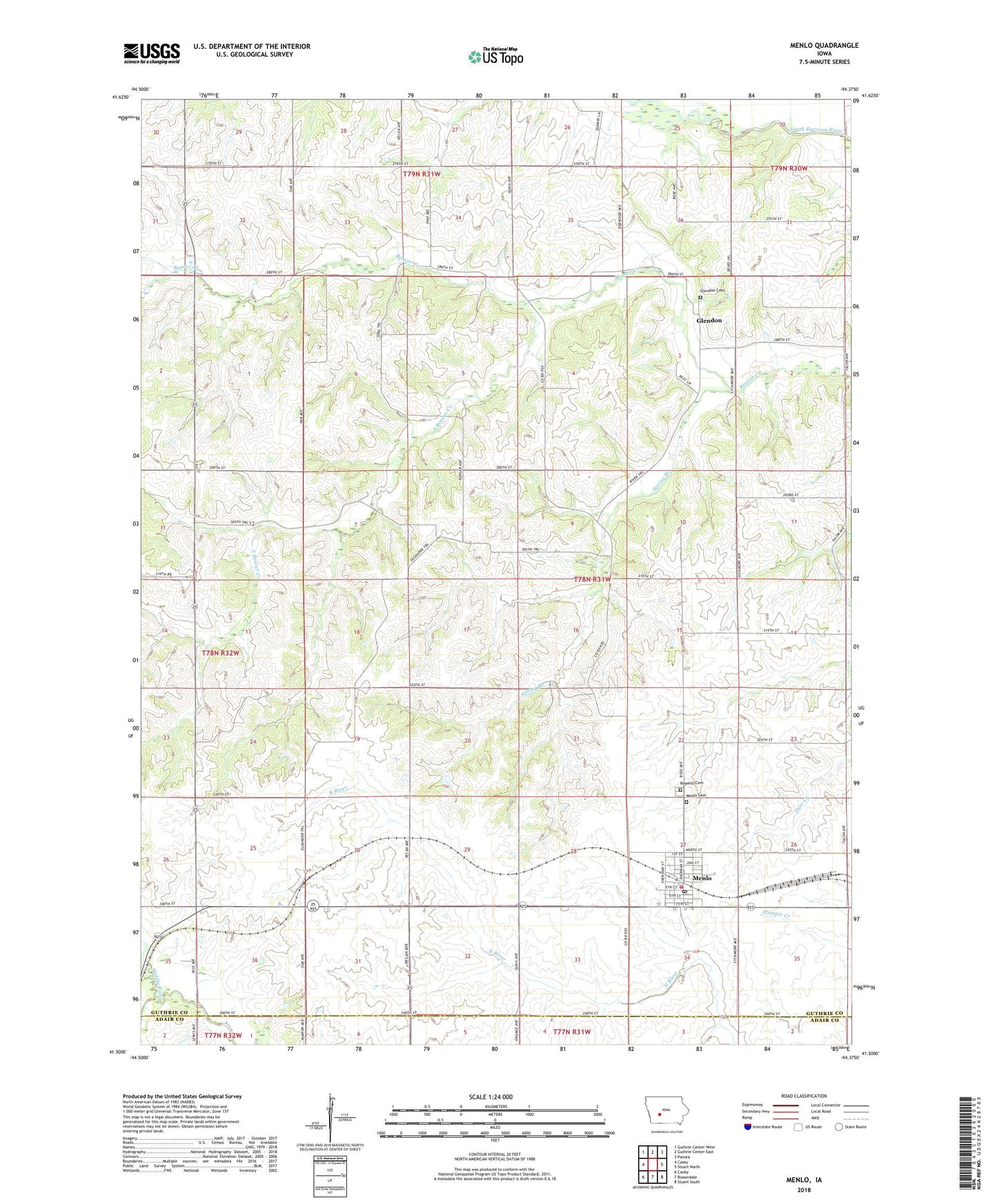
2022 topographic map quadrangle Menlo in the state of Iowa. Scale: 1:24000. Based on the newly updated USGS 7.5' US Topo map series, this map is in the following counties: Guthrie, Adair. The map contains contour data, water features, and other items you are used to seeing on USGS maps, but also has updated roads and other features. This is the next generation of topographic maps. Printed on high-quality waterproof paper with UV fade-resistant inks.
Quads adjacent to this one:
West: Casey
Northwest: Guthrie Center West
North: Guthrie Center East
Northeast: Panora
East: Stuart North
Southeast: Stuart South
South: Rosserdale
Southwest: Canby
This map covers the same area as the classic USGS quad with code o41094e4.
Contains the following named places: Ava Post Office, Church of Christ, City of Menlo, Frog Pond School, Glendon, Glendon Cemetery, Glendon Post Office, Menlo, Menlo Cemetery, Menlo City Hall, Menlo Elementary School, Menlo Fire and Rescue, Menlo Library, Menlo Post Office, Methodist Episcopal Church, Montieth Wildlife Area, Morning Star School, Primitive Church, Ridgeway Post Office, Rosehill Cemetery, South Beaver Creek, Spring Branch, Township of Beaver