MyTopo
Stuart South Iowa US Topo Map
Couldn't load pickup availability
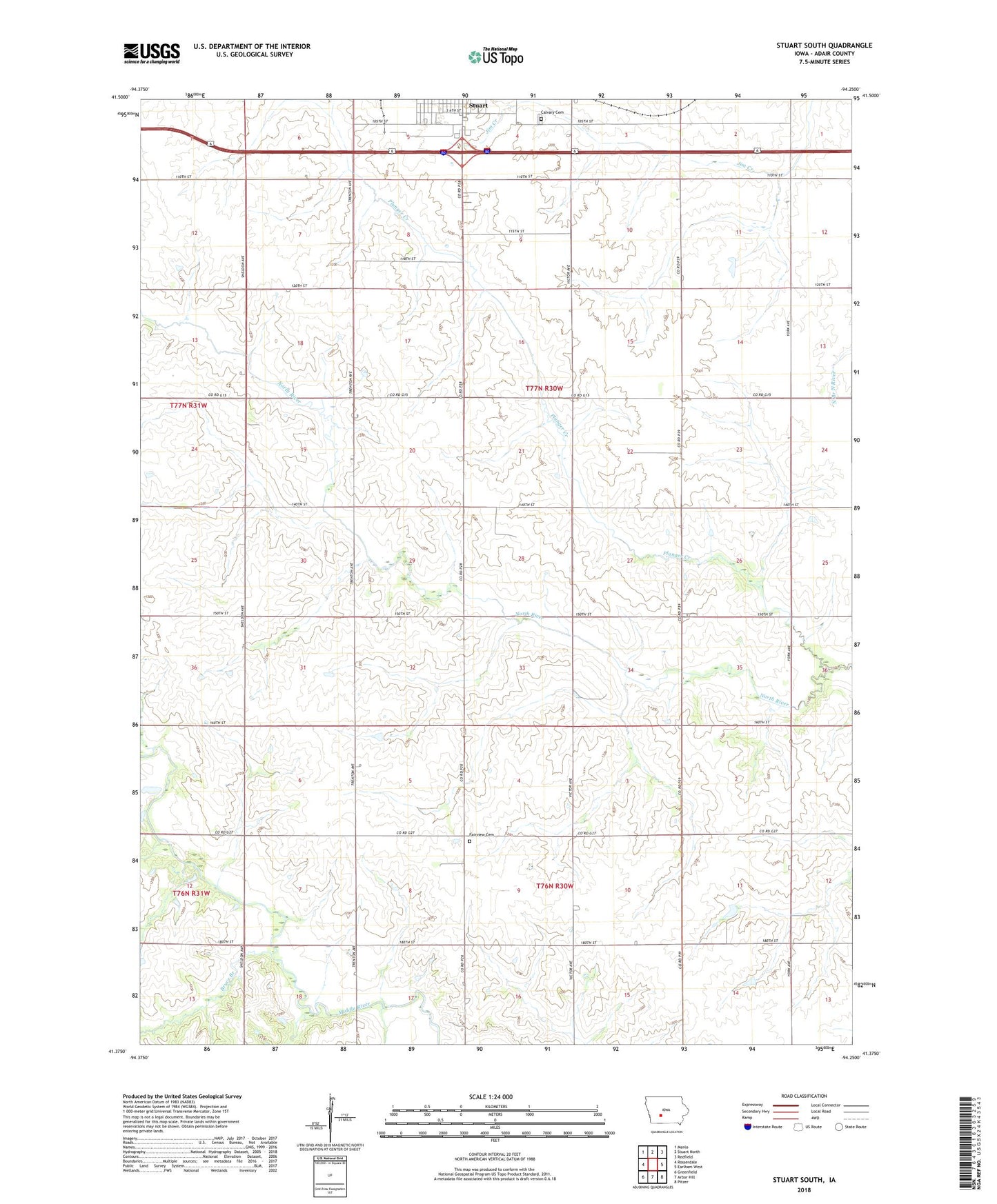
2022 topographic map quadrangle Stuart South in the state of Iowa. Scale: 1:24000. Based on the newly updated USGS 7.5' US Topo map series, this map is in the following counties: Adair. The map contains contour data, water features, and other items you are used to seeing on USGS maps, but also has updated roads and other features. This is the next generation of topographic maps. Printed on high-quality waterproof paper with UV fade-resistant inks.
Quads adjacent to this one:
West: Rosserdale
Northwest: Menlo
North: Stuart North
Northeast: Redfield
East: Earlham West
Southeast: Pitzer
South: Arbor Hill
Southwest: Greenfield
This map covers the same area as the classic USGS quad with code o41094d3.
Contains the following named places: Bruce Branch, Calvary Cemetery, Community Care Center, Eye Care Associates Center, Fairview Cemetery, Fairview Church, Harmony School, Lincoln Townhall, McKinley Post Office, Mount Vernon Church, Mount Vernon School, North River School, Pleasant Ridge School, Plunger Creek, Prairie Queen School, Stuart Family Care Center, Stuart Family Practice Center, Township of Lincoln, Wah-Ta-Wah Post Office, Wasson Landing Strip, ZIP Code: 50250