MyTopo
Rosserdale Iowa US Topo Map
Couldn't load pickup availability
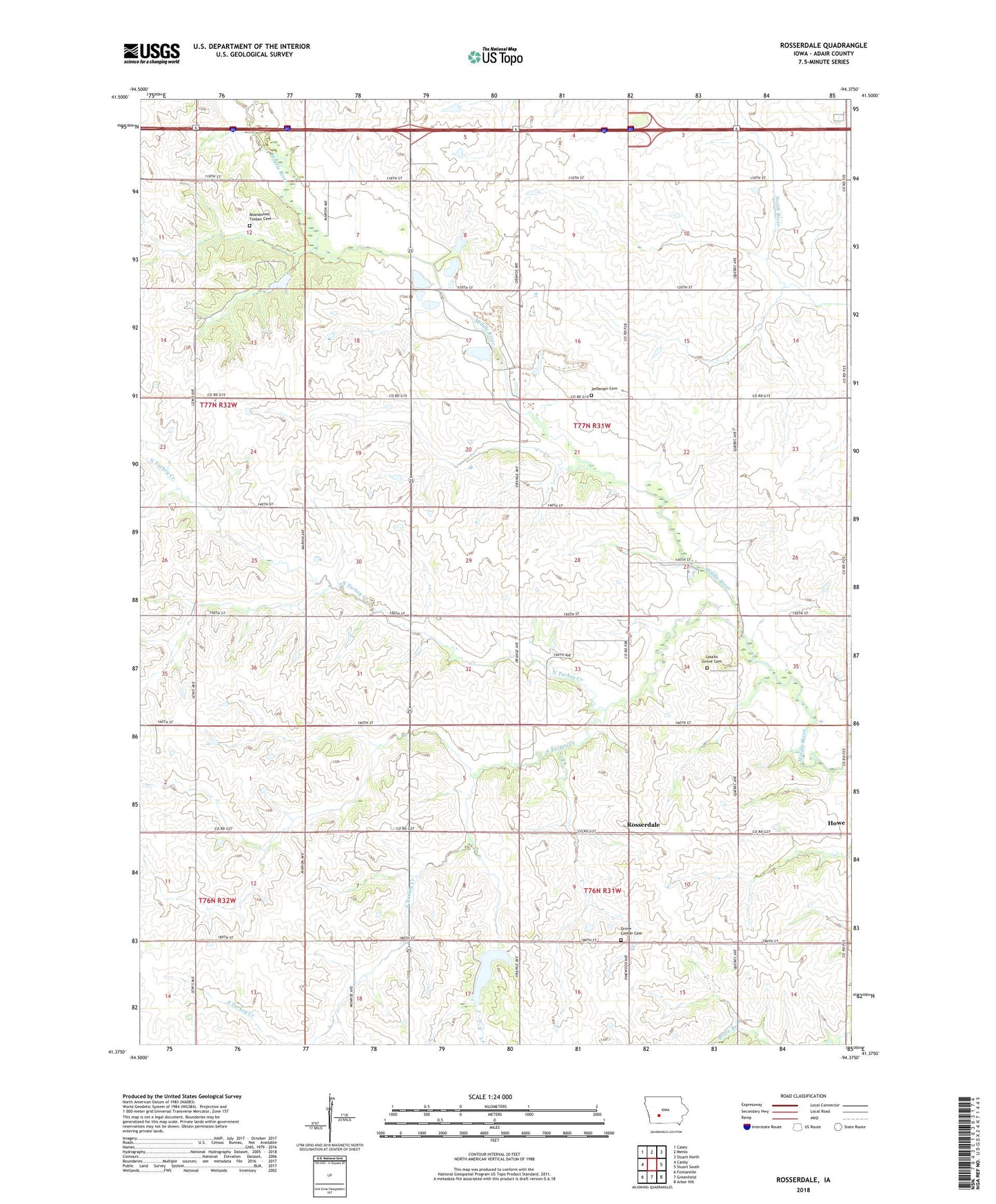
2022 topographic map quadrangle Rosserdale in the state of Iowa. Scale: 1:24000. Based on the newly updated USGS 7.5' US Topo map series, this map is in the following counties: Adair. The map contains contour data, water features, and other items you are used to seeing on USGS maps, but also has updated roads and other features. This is the next generation of topographic maps. Printed on high-quality waterproof paper with UV fade-resistant inks.
Quads adjacent to this one:
West: Canby
Northwest: Casey
North: Menlo
Northeast: Stuart North
East: Stuart South
Southeast: Arbor Hill
South: Greenfield
Southwest: Fontanelle
This map covers the same area as the classic USGS quad with code o41094d4.
Contains the following named places: 5 x 80 Golf Course, 50164, Abandoned Timber Cemetery, Grove Center Cemetery, Grove Center Church, Holadays, Holadays Post Office, Howe, Howe Post Office, Jefferson Cemetery, Jefferson Center Church, Jefferson Townhall, Loucks Grove Cemetery, Loucks Grove Church, Meadow Lake, Meadow Lake Dam, Meadow Lake State Public Hunting Area, Menlo Quarry, North Turkey Creek, Prussia Post Office, Rosserdale, Shelley Landing Strip, South Turkey Creek, Township of Jefferson