MyTopo
Nashua NW Iowa US Topo Map
Couldn't load pickup availability
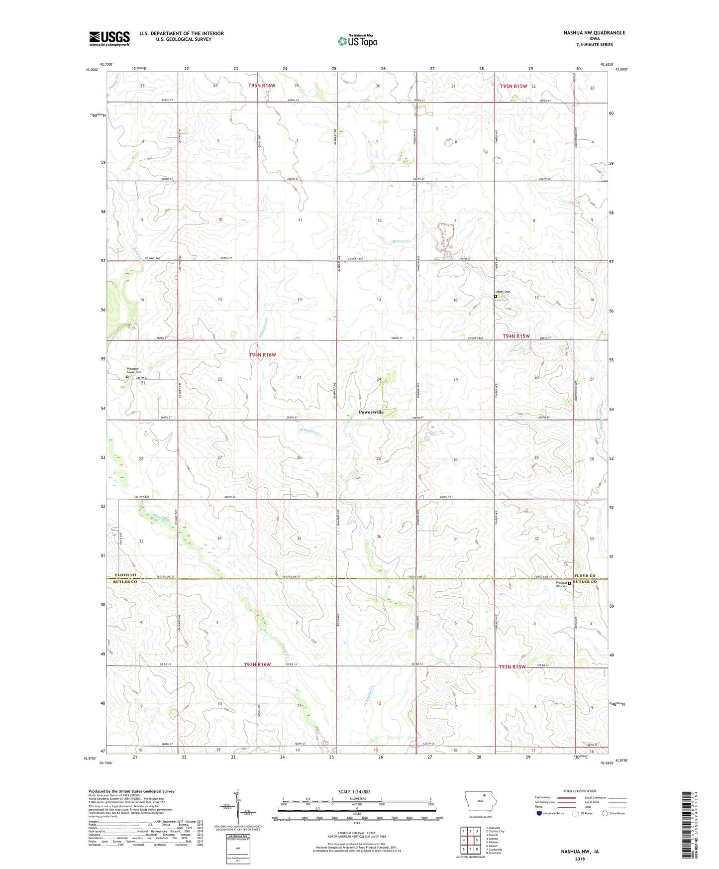
2022 topographic map quadrangle Nashua NW in the state of Iowa. Scale: 1:24000. Based on the newly updated USGS 7.5' US Topo map series, this map is in the following counties: Floyd, Butler. The map contains contour data, water features, and other items you are used to seeing on USGS maps, but also has updated roads and other features. This is the next generation of topographic maps. Printed on high-quality waterproof paper with UV fade-resistant inks.
Quads adjacent to this one:
West: Greene
Northwest: Roseville
North: Charles City
Northeast: Bassett
East: Nashua
Southeast: Plainfield
South: Clarksville
Southwest: Allison
This map covers the same area as the classic USGS quad with code o42092h6.
Contains the following named places: Liggett Cemetery, Pleasant Grove Cemetery, Pleasant Hill Cemetery, Powersville, Powersville Post Office, Saint Johns Church, Township of Pleasant Grove, United Church