MyTopo
Allison Iowa US Topo Map
Couldn't load pickup availability
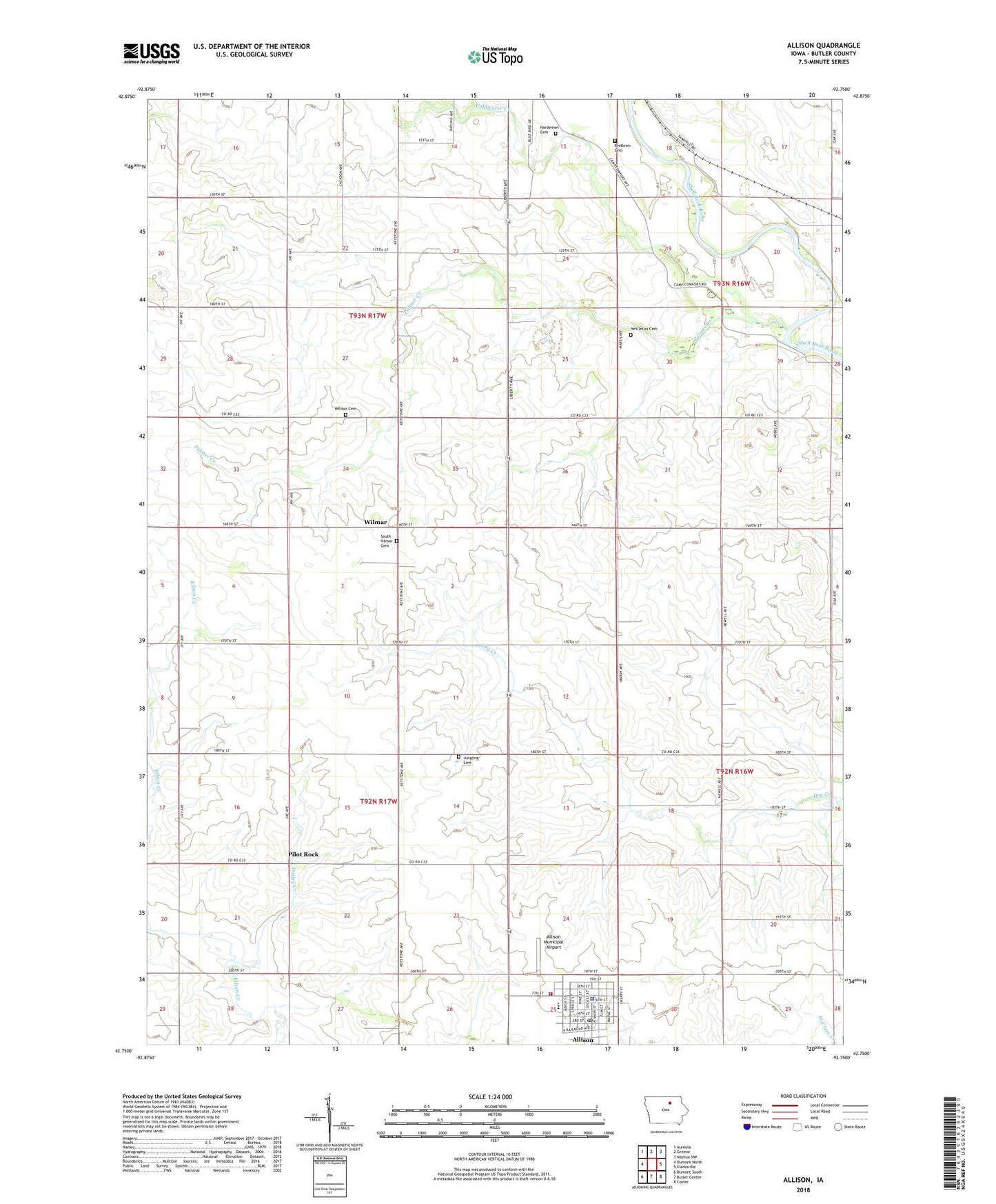
2022 topographic map quadrangle Allison in the state of Iowa. Scale: 1:24000. Based on the newly updated USGS 7.5' US Topo map series, this map is in the following counties: Butler. The map contains contour data, water features, and other items you are used to seeing on USGS maps, but also has updated roads and other features. This is the next generation of topographic maps. Printed on high-quality waterproof paper with UV fade-resistant inks.
Quads adjacent to this one:
West: Dumont North
Northwest: Aureola
North: Greene
Northeast: Nashua NW
East: Clarksville
Southeast: Coster
South: Butler Center
Southwest: Dumont South
This map covers the same area as the classic USGS quad with code o42092g7.
Contains the following named places: Allison, Allison Bristow Ambulance, Allison Care Center, Allison Chiropractic Office, Allison City Hall, Allison Municipal Airport, Allison Post Office, Allison Public Library, Allison Volunteer Fire Department, Brethren Cemetery, Butler County Courthouse, Butler County Sheriff's Office, Camp Comfort, City of Allison, Coldwater Creek, Dailey Creek, Hardman Cemetery, Jungling Cemetery, Maudville Post Office, Nettleton Cemetery, North Butler Elementary School, North Butler Middle School, North Vilmar Cemetery, Palmer Creek, Pilot Rock, Pittsford School Number Three, Saint James Lutheran Church, Saint Johns Church, South Vilmar Cemetery, Township of Coldwater, Township of West Point, Trinity Reformed Church, United Church of Christ, Vilmar Post Office, Wilmar