MyTopo
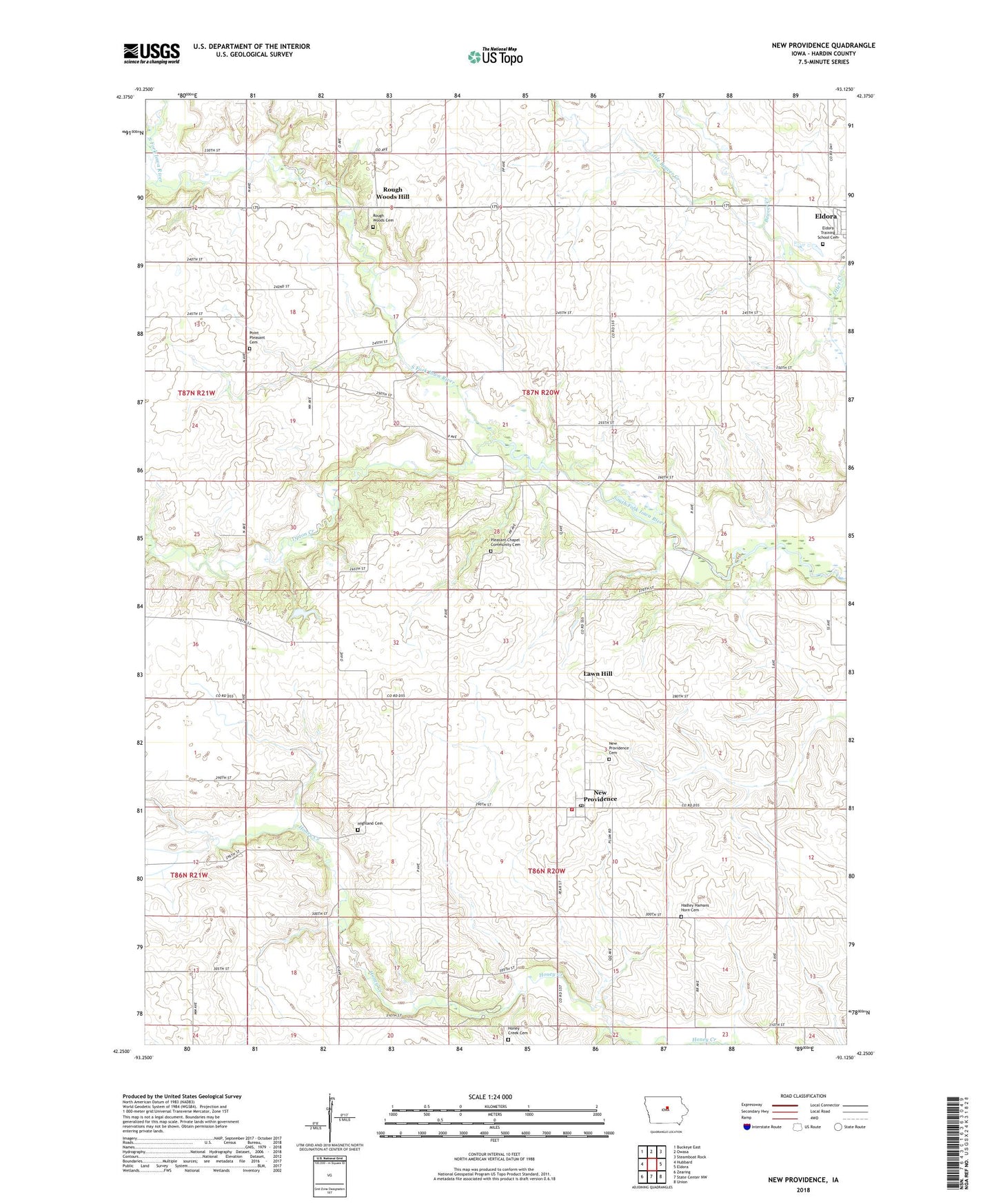
New Providence Iowa US Topo Map
Couldn't load pickup availability
2022 topographic map quadrangle New Providence in the state of Iowa. Scale: 1:24000. Based on the newly updated USGS 7.5' US Topo map series, this map is in the following counties: Hardin. The map contains contour data, water features, and other items you are used to seeing on USGS maps, but also has updated roads and other features. This is the next generation of topographic maps. Printed on high-quality waterproof paper with UV fade-resistant inks.
Quads adjacent to this one:
West: Hubbard
Northwest: Buckeye East
North: Owasa
Northeast: Steamboat Rock
East: Eldora
Southeast: Union
South: State Center NW
Southwest: Zearing
This map covers the same area as the classic USGS quad with code o42093c2.
Contains the following named places: Bunker Hill Post Office, City of New Providence, Eldora Training School Cemetery, First Church/Cemetery Historical Marker, Hadley Cemetery, Highland Cemetery, Honey Creek Cemetery, Honey Creek Church, J L Reece Memorial Park, Lawn Hill, Lawnhill Post Office, Little Beaver Creek, Midland Post Office, New Providence, New Providence Cemetery, New Providence Fire Department, New Providence Post Office, New Providence Town Hall, Otter Creek, Pleasant Chapel Community Cemetery, Pleasant Chapel Community Church, Point Pleasant, Point Pleasant Cemetery, Point Pleasant Post Office, Quakerdale School, Quebec Post Office, Rough Woods Cemetery, Rough Woods Hill, Tipton Creek, Township of Pleasant, Township of Providence, Ziesman Wildlife Area