MyTopo
Zearing Iowa US Topo Map
Couldn't load pickup availability
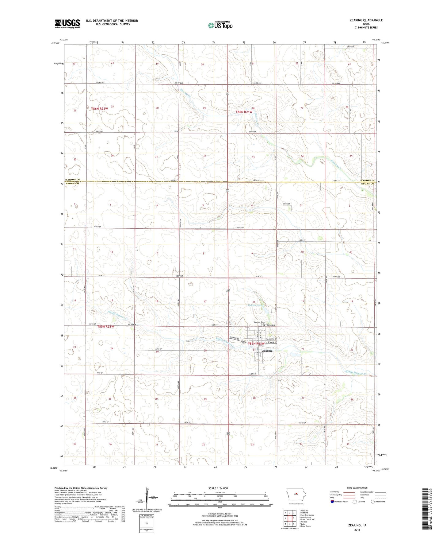
2022 topographic map quadrangle Zearing in the state of Iowa. Scale: 1:24000. Based on the newly updated USGS 7.5' US Topo map series, this map is in the following counties: Story, Hardin. The map contains contour data, water features, and other items you are used to seeing on USGS maps, but also has updated roads and other features. This is the next generation of topographic maps. Printed on high-quality waterproof paper with UV fade-resistant inks.
Quads adjacent to this one:
West: McCallsburg
Northwest: Radcliffe
North: Hubbard
Northeast: New Providence
East: State Center NW
Southeast: State Center
South: Colo
Southwest: Nevada
This map covers the same area as the classic USGS quad with code o42093b3.
Contains the following named places: Bethel United Methodist Church, City of Zearing, Colo - NESCO Community Elementary School, Colonial Manor of Zearing, Cornerstone Church of Christ, Dakins Lake, Dakins Lake Park, Saint Gabriel's Catholic Church, Sunset Post Office, Township of Lincoln, Veterans Memorial Field, Zearing, Zearing Cemetery, Zearing Christian Church, Zearing Fire Department, Zearing Medical Clinic, Zearing Post Office, Zearing Public Library, Zearing Town Hall, ZIP Code: 50278