MyTopo
Osage Iowa US Topo Map
Couldn't load pickup availability
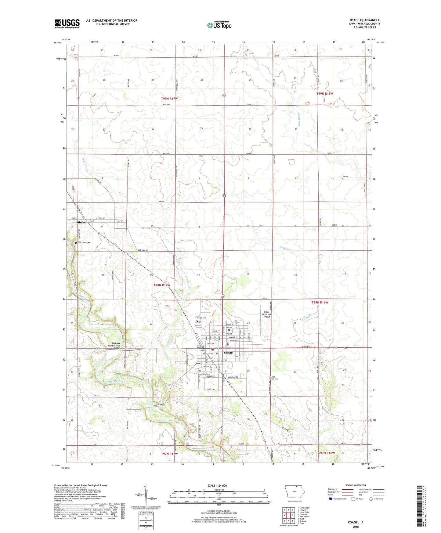
2022 topographic map quadrangle Osage in the state of Iowa. Scale: 1:24000. Based on the newly updated USGS 7.5' US Topo map series, this map is in the following counties: Mitchell. The map contains contour data, water features, and other items you are used to seeing on USGS maps, but also has updated roads and other features. This is the next generation of topographic maps. Printed on high-quality waterproof paper with UV fade-resistant inks.
Quads adjacent to this one:
West: Osage SW
Northwest: Saint Ansgar
North: Stacyville
Northeast: Little Cedar
East: New Haven
Southeast: Floyd
South: Orchard
Southwest: Rudd
This map covers the same area as the classic USGS quad with code o43092c7.
Contains the following named places: Bennett Access, Cedar River Greenbelt Trail, Cedar Valley Memories Museum, Cedar Valley Seminary, Christian Missionary Church, City of Mitchell, City of Osage, Faith Nursing Home, Falk Wildlife Area, First Baptist Church, First United Methodist Church, Fuller Post Office, Highway Number Nine Bridge, KCZY-FM (Osage), KIMT-TV (Mason City), KYIN-TV (Mason City), Lincoln Elementary School, Mitchell, Mitchell County, Mitchell County Courthouse, Mitchell County Fairgrounds, Mitchell County Home, Mitchell County Memorial Hospital, Mitchell County Regional Health Center, Mitchell County Regional Health Center / Ambulance Department, Mitchell County Sheriff's Office, Mitchell Post Office, Oak Grove Cemetery, Old Stone Mill Historical Marker, Osage, Osage Cemetery, Osage City Hall, Osage City Park, Osage Co-op Elevator, Osage Dental Arts Center, Osage Fire Department, Osage High School, Osage Middle School, Osage Municipal Airport, Osage Police Department, Osage Post Office, Osage Public Library, Osage Spring Park, Osage Wastewater Treatment Plant, Our Saviours Lutheran Church, Sacred Heart Catholic Church, Sacred Heart Cemetery, Sacred Heart School, Student Hamlin Garland Historical Marker, Sugar Creek, Sunny Brae Golf Club, The Dragoons - Mitchell County Historical Marker, Town and Country Plaza, Township of Mitchell, Township of Osage, Trinity Lutheran Church, United Church of Christ, Washington Elementary School, West Mitchell Post Office, ZIP Code: 50461