MyTopo
Quimby Iowa US Topo Map
Couldn't load pickup availability
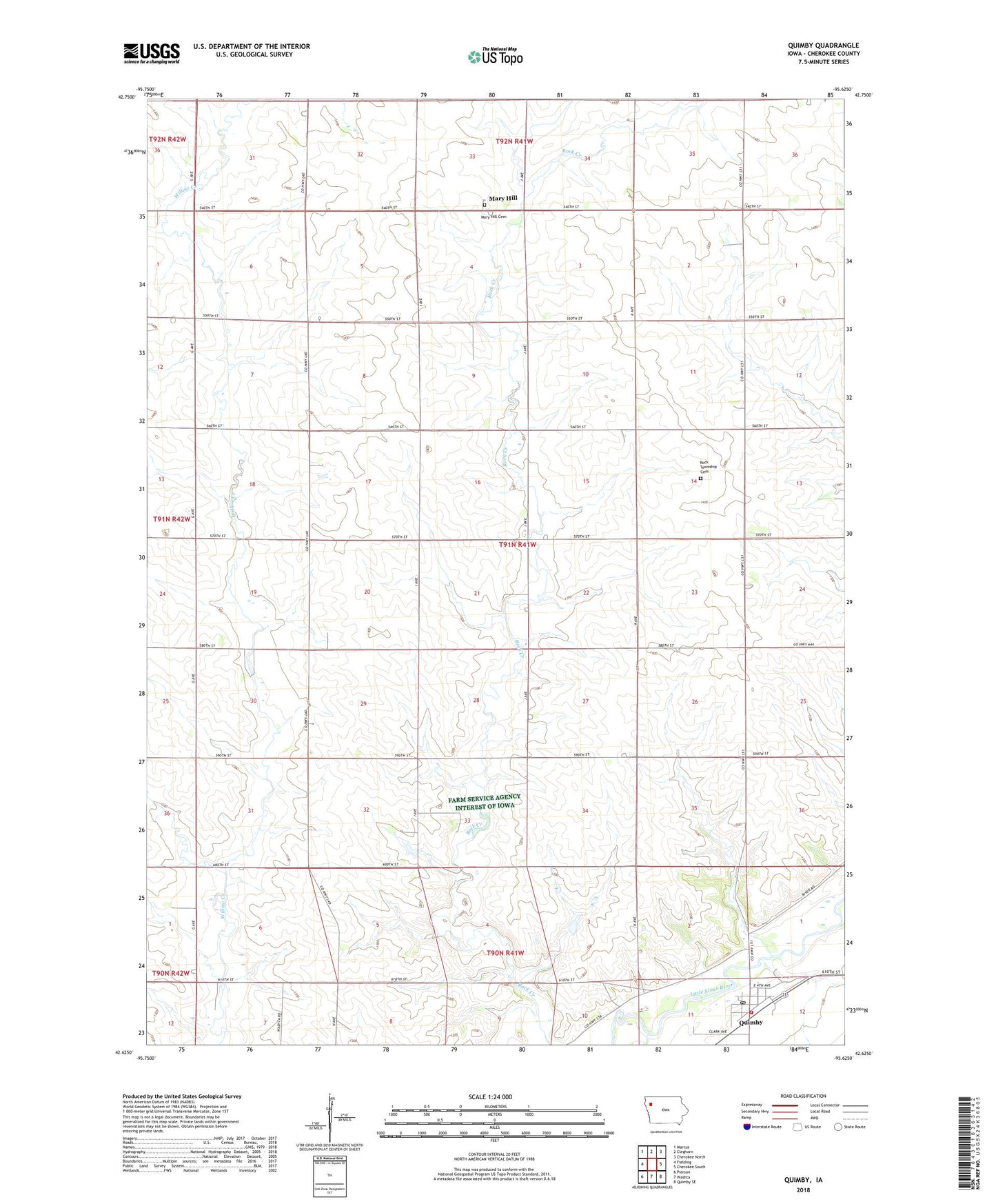
2022 topographic map quadrangle Quimby in the state of Iowa. Scale: 1:24000. Based on the newly updated USGS 7.5' US Topo map series, this map is in the following counties: Cherokee. The map contains contour data, water features, and other items you are used to seeing on USGS maps, but also has updated roads and other features. This is the next generation of topographic maps. Printed on high-quality waterproof paper with UV fade-resistant inks.
Quads adjacent to this one:
West: Fielding
Northwest: Marcus
North: Cleghorn
Northeast: Cherokee North
East: Cherokee South
Southeast: Quimby SE
South: Washta
Southwest: Pierson
This map covers the same area as the classic USGS quad with code o42095f6.
Contains the following named places: Baum Post Office, City of Quimby, Fourmile Creek, Mary Hill, Maryhill Visitation Cemetery, Maryhill Visitation Church, Methodist Church, N and G Fur Farm, Nelson Farms, Pilgrim Lutheran Church, Quimby, Quimby Baptist Church, Quimby Fire Department, Quimby Golf Course, Quimby Post Office, Quimby Public Library, Rock Township Cemetery, Saint Johns Catholic Church, Township of Rock, Zimmer Farms, ZIP Code: 51049