MyTopo
Portsmouth Iowa US Topo Map
Couldn't load pickup availability
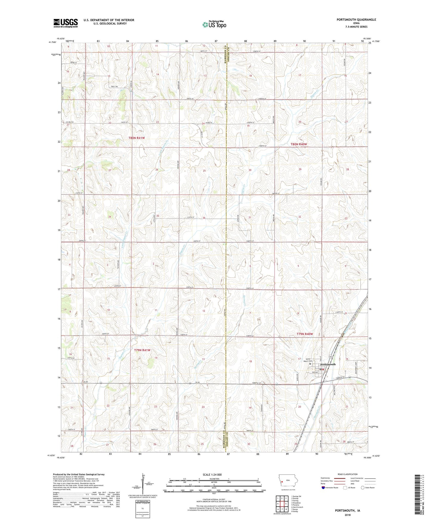
2022 topographic map quadrangle Portsmouth in the state of Iowa. Scale: 1:24000. Based on the newly updated USGS 7.5' US Topo map series, this map is in the following counties: Harrison, Shelby. The map contains contour data, water features, and other items you are used to seeing on USGS maps, but also has updated roads and other features. This is the next generation of topographic maps. Printed on high-quality waterproof paper with UV fade-resistant inks.
Quads adjacent to this one:
West: Woodbine
Northwest: Dunlap SW
North: Dunlap
Northeast: Earling
East: Panama
Southeast: Shelby
South: Persia
Southwest: Hard Scratch
This map covers the same area as the classic USGS quad with code o41095f5.
Contains the following named places: City of Portsmouth, G and R Feed and Grain Company Elevator, Little Pigeon Creek, Portsmouth, Portsmouth Cass Township Fire Department, Portsmouth Elevator, Portsmouth Post Office, Saint Marys Catholic Church, Saint Mary's Cemetery, Township of Cass, Township of Douglas, ZIP Code: 51565