MyTopo
Persia Iowa US Topo Map
Couldn't load pickup availability
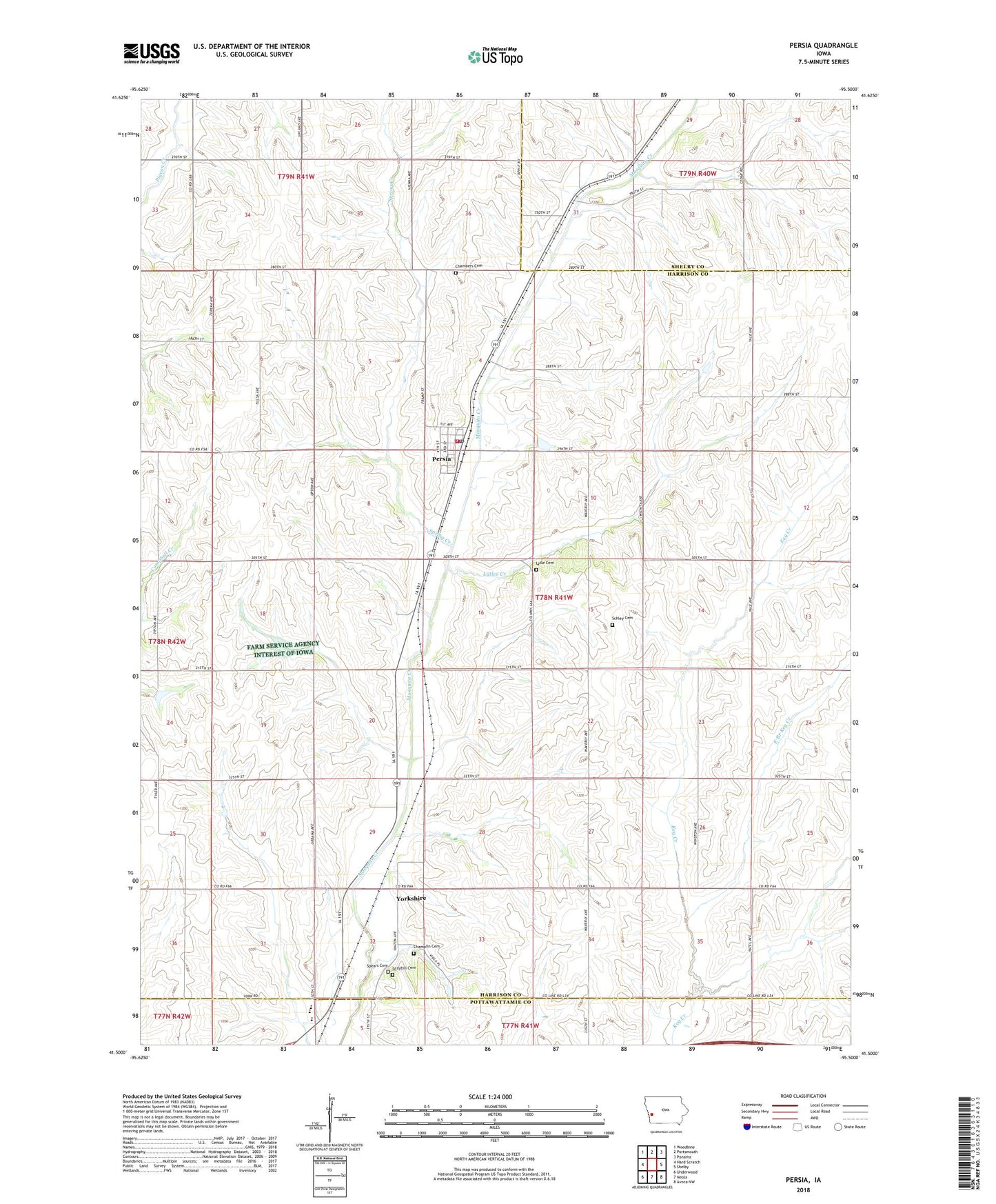
2022 topographic map quadrangle Persia in the state of Iowa. Scale: 1:24000. Based on the newly updated USGS 7.5' US Topo map series, this map is in the following counties: Harrison, Shelby, Pottawattamie. The map contains contour data, water features, and other items you are used to seeing on USGS maps, but also has updated roads and other features. This is the next generation of topographic maps. Printed on high-quality waterproof paper with UV fade-resistant inks.
Quads adjacent to this one:
West: Hard Scratch
Northwest: Woodbine
North: Portsmouth
Northeast: Panama
East: Shelby
Southeast: Avoca NW
South: Neola
Southwest: Underwood
This map covers the same area as the classic USGS quad with code o41095e5.
Contains the following named places: Chambers Cemetery, Champlin Cemetery, City of Persia, East Branch Keg Creek, Graybill Cemetery, Lytle Cemetery, Lytles Creek, Magill, Persia, Persia City Hall, Persia Fire and Rescue, Persia Methodist Church, Persia Post Office, Reorganized Church of Jesus Christ of Latter Day Saints, Rock Run Post Office, Saint John Lutheran Church, Sampson, Sampson Post Office, Schley Cemetery, Schley Park, Spears Cemetery, Spring Creek, Township of Washington, Tri - Center Elementary School, Tri - Center High School, Tri - Center Middle School, Trinity Lutheran Church, Yorkshire, Yorkshire Post Office, ZIP Code: 51563