MyTopo
Hard Scratch Iowa US Topo Map
Couldn't load pickup availability
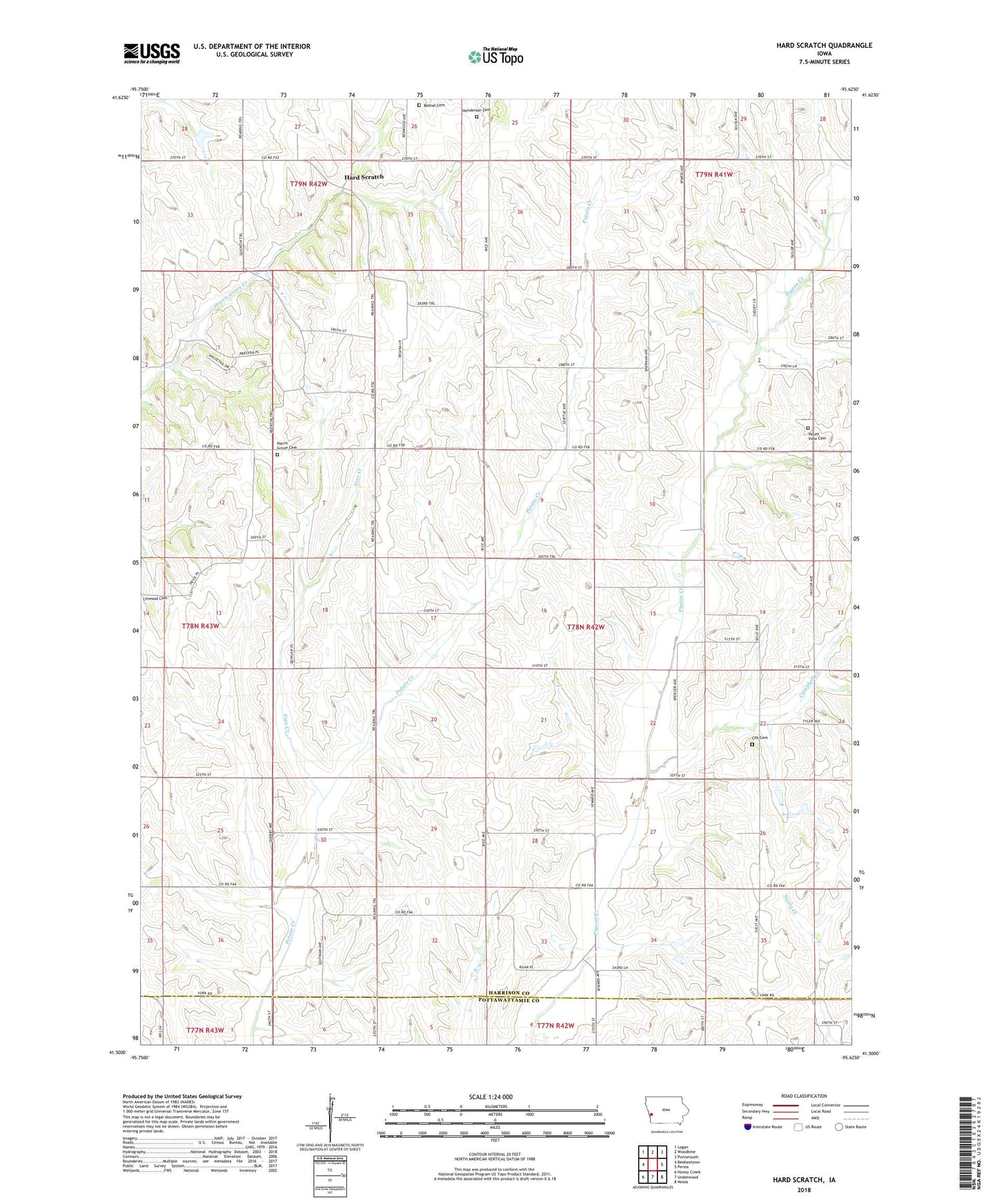
2022 topographic map quadrangle Hard Scratch in the state of Iowa. Scale: 1:24000. Based on the newly updated USGS 7.5' US Topo map series, this map is in the following counties: Harrison, Pottawattamie. The map contains contour data, water features, and other items you are used to seeing on USGS maps, but also has updated roads and other features. This is the next generation of topographic maps. Printed on high-quality waterproof paper with UV fade-resistant inks.
Quads adjacent to this one:
West: Beebeetown
Northwest: Logan
North: Woodbine
Northeast: Portsmouth
East: Persia
Southeast: Neola
South: Underwood
Southwest: Honey Creek
This map covers the same area as the classic USGS quad with code o41095e6.
Contains the following named places: Bethel Cemetery, Campbell Creek, Cox Cemetery, Crisp, Crisp Post Office, Hard Scratch, Harris Grove Cemetery, Harris Grove Church, Harris Grove Post Office, Henderson Cemetery, Mount Norris Post Office, Readers Mills, Reeder Mills Post Office, Township of Union, Union Burg, Unionburgh Post Office, Valley View Cemetery, Valley View Post Office, Vore Creek