MyTopo
Salina Iowa US Topo Map
Couldn't load pickup availability
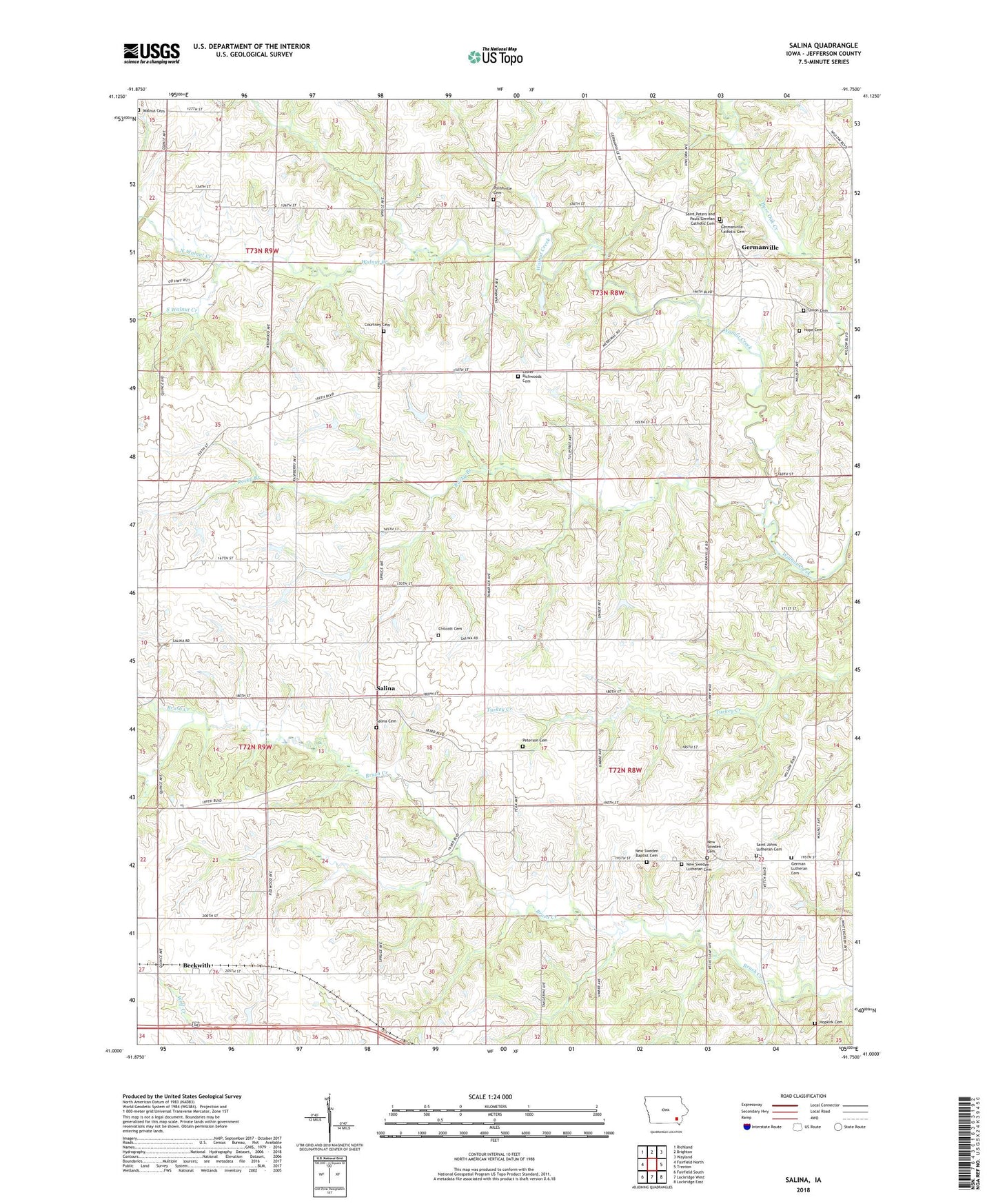
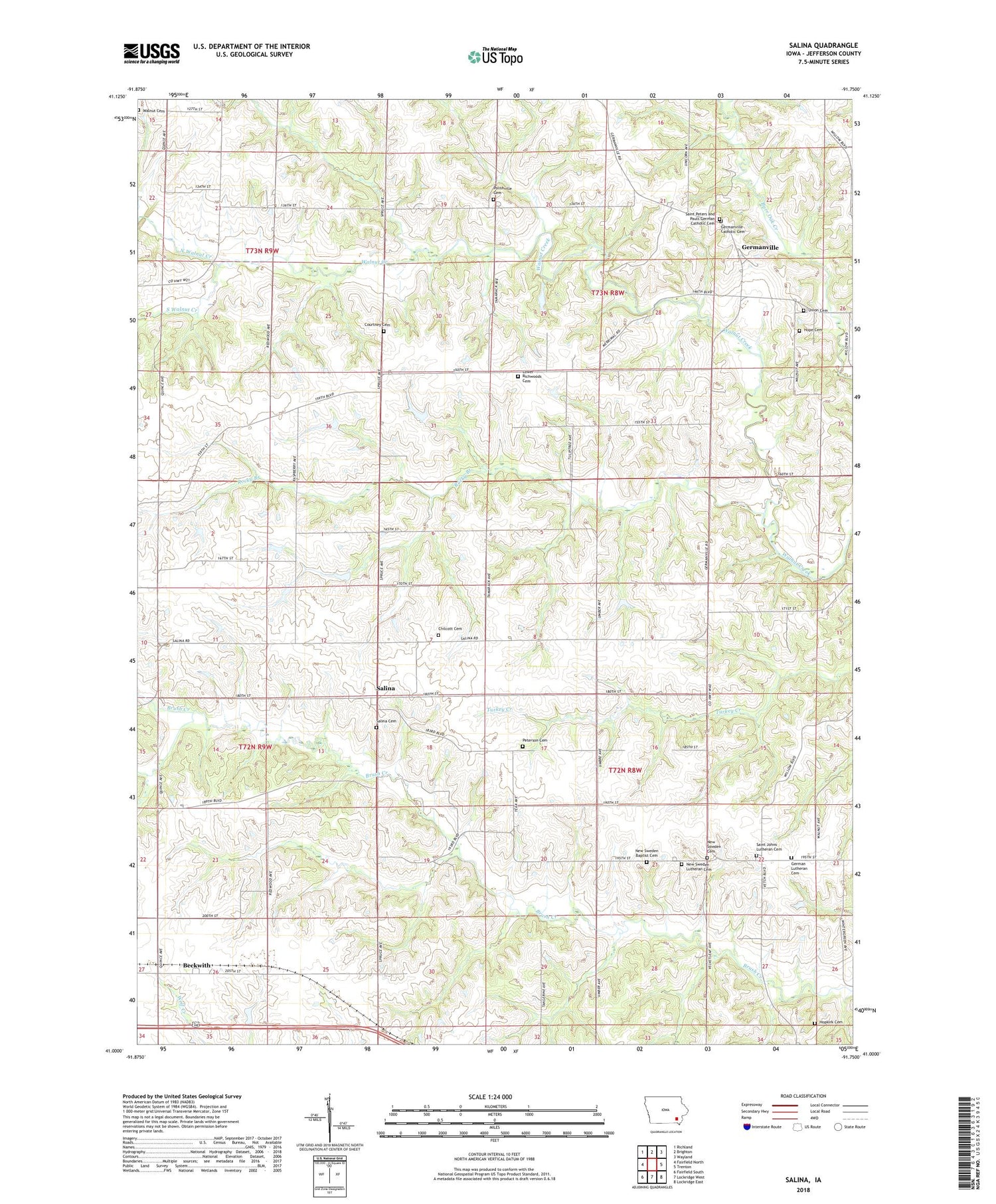
2022 topographic map quadrangle Salina in the state of Iowa. Scale: 1:24000. Based on the newly updated USGS 7.5' US Topo map series, this map is in the following counties: Jefferson. The map contains contour data, water features, and other items you are used to seeing on USGS maps, but also has updated roads and other features. This is the next generation of topographic maps. Printed on high-quality waterproof paper with UV fade-resistant inks.
Quads adjacent to this one:
West: Fairfield North
Northwest: Richland
North: Brighton
Northeast: Wayland
East: Trenton
Southeast: Lockridge East
South: Lockridge West
Southwest: Fairfield South
This map covers the same area as the classic USGS quad with code o41091a7.
Contains the following named places: Beckwith, Beckwith Post Office, Chilcott Cemetery, Courtney Cemetery, Four Corners German Lutheran Cemetery, Four Corners Post Office, Germanville, Germanville Post Office, Harveys Mills Post Office, Hope Church, Hope Lutheran Cemetery, Hopkirk Cemetery, Lower Richwoods Cemetery, New Sweden Baptist Cemetery, New Sweden Baptist Church, New Sweden Cemetery, New Sweden Lutheran Cemetery, New Sweden Lutheran Church, North Walnut Creek, Parsonville Post Office, Peterson Cemetery, Polishville Cemetery, Rocky Branch, Saint Johns Lutheran Cemetery, Saint Peters and Pauls German Catholic Cemetery, Saints Peter and Paul Catholic Cemetery, Salina, Salina Cemetery, Salina Post Office, South Walnut Creek, Township of Lockridge, Township of Walnut, Union Free Cemetery, Walnut Cemetery