MyTopo
Richland Iowa US Topo Map
Couldn't load pickup availability
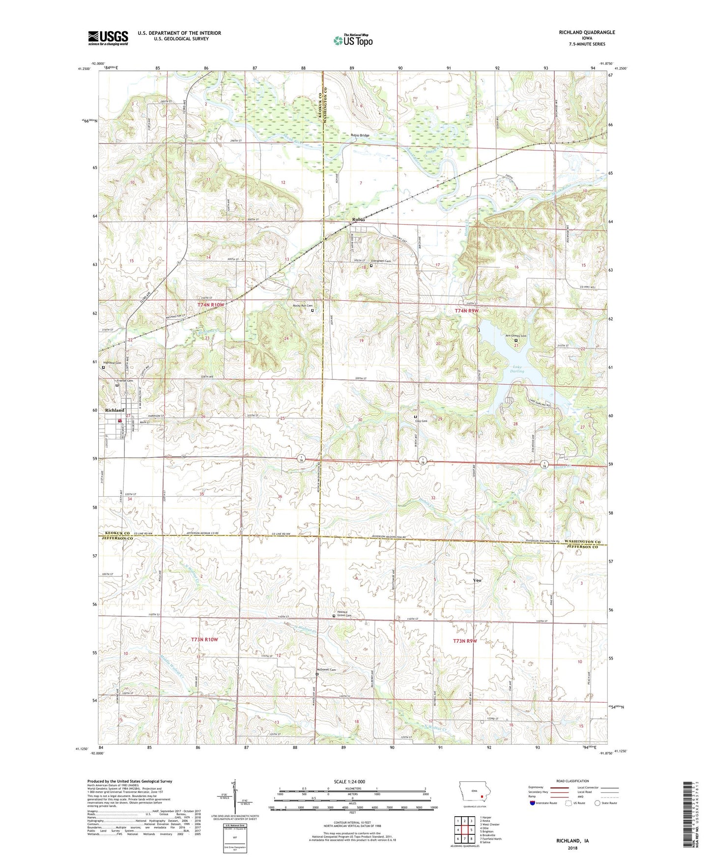
2022 topographic map quadrangle Richland in the state of Iowa. Scale: 1:24000. Based on the newly updated USGS 7.5' US Topo map series, this map is in the following counties: Washington, Jefferson, Keokuk. The map contains contour data, water features, and other items you are used to seeing on USGS maps, but also has updated roads and other features. This is the next generation of topographic maps. Printed on high-quality waterproof paper with UV fade-resistant inks.
Quads adjacent to this one:
West: Ollie
Northwest: Harper
North: Keota
Northeast: West Chester
East: Brighton
Southeast: Salina
South: Fairfield North
Southwest: Brookville
This map covers the same area as the classic USGS quad with code o41091b8.
Contains the following named places: Ann Gowey Cemetery, Bond Hill County Park, Brayo, Brays Post Office, City of Richland, Clay, Clay Cemetery, Clay Post Office, Dutch Creek, Evergreen Cemetery, Friends Cemetery, Highland Cemetery, Honey Creek, Hopewell Friends Church, Howard Grove Cemetery, Lake Darling, Lake Darling State Park, McDowell Cemetery, McKain State Access Area, Mother Cabrini Catholic Church, Richland, Richland City Hall, Richland Creek, Richland Fire Department, Richland Post Office, Richland Public Library, Richland United Methodist Church, Rocky Run Cemetery, Rubio, Rubio Bridge, Rubio Friends Church, Rubio Post Office, Rubio State Access Area, Solid Rock Fellowship, Township of Clay, Trinity Friends Church, Veo, Veo Post Office, Woolson, Woolson Friends Church, Woolson Post Office, ZIP Code: 52585