MyTopo
Shenandoah West Iowa US Topo Map
Couldn't load pickup availability
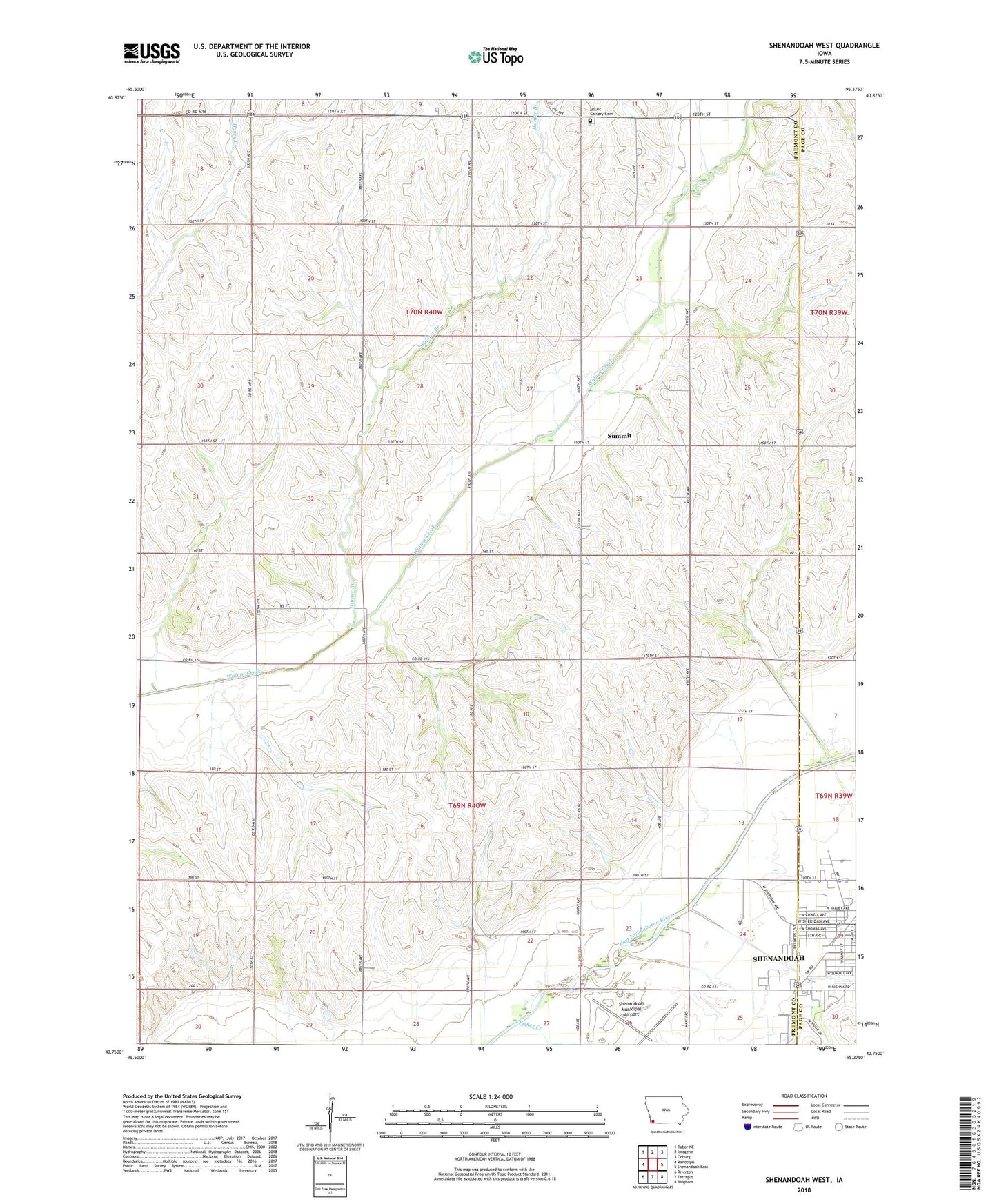
2022 topographic map quadrangle Shenandoah West in the state of Iowa. Scale: 1:24000. Based on the newly updated USGS 7.5' US Topo map series, this map is in the following counties: Fremont, Page. The map contains contour data, water features, and other items you are used to seeing on USGS maps, but also has updated roads and other features. This is the next generation of topographic maps. Printed on high-quality waterproof paper with UV fade-resistant inks.
Quads adjacent to this one:
West: Randolph
Northwest: Tabor NE
North: Imogene
Northeast: Coburg
East: Shenandoah East
Southeast: Bingham
South: Farragut
Southwest: Riverton
This map covers the same area as the classic USGS quad with code o40095g4.
Contains the following named places: Corey, Cory Post Office, Fair Oaks Care Center, Faith Christian Fellowship, Farmer City, Farmer City Post Office, Fiftyniner Motel and Campgrounds, Fisher Creek, Garden View Care Center, Grace Community Fellowship, Hunter Branch, Living Word Academy, Lowell Avenue Elementary School, Memorial Baptist Church, Mercy Center of Shenandoah, Mount Calvary Cemetery, New Testament Church of Christ, Nunda, Nunda Post Office, Shenandoah, Shenandoah Municipal Airport, Summit, Towell Avenue School, Township of Monroe, Township of Walnut, Vaughn Post Office, Walnut Creek Post Office