MyTopo
Tabor NE Iowa US Topo Map
Couldn't load pickup availability
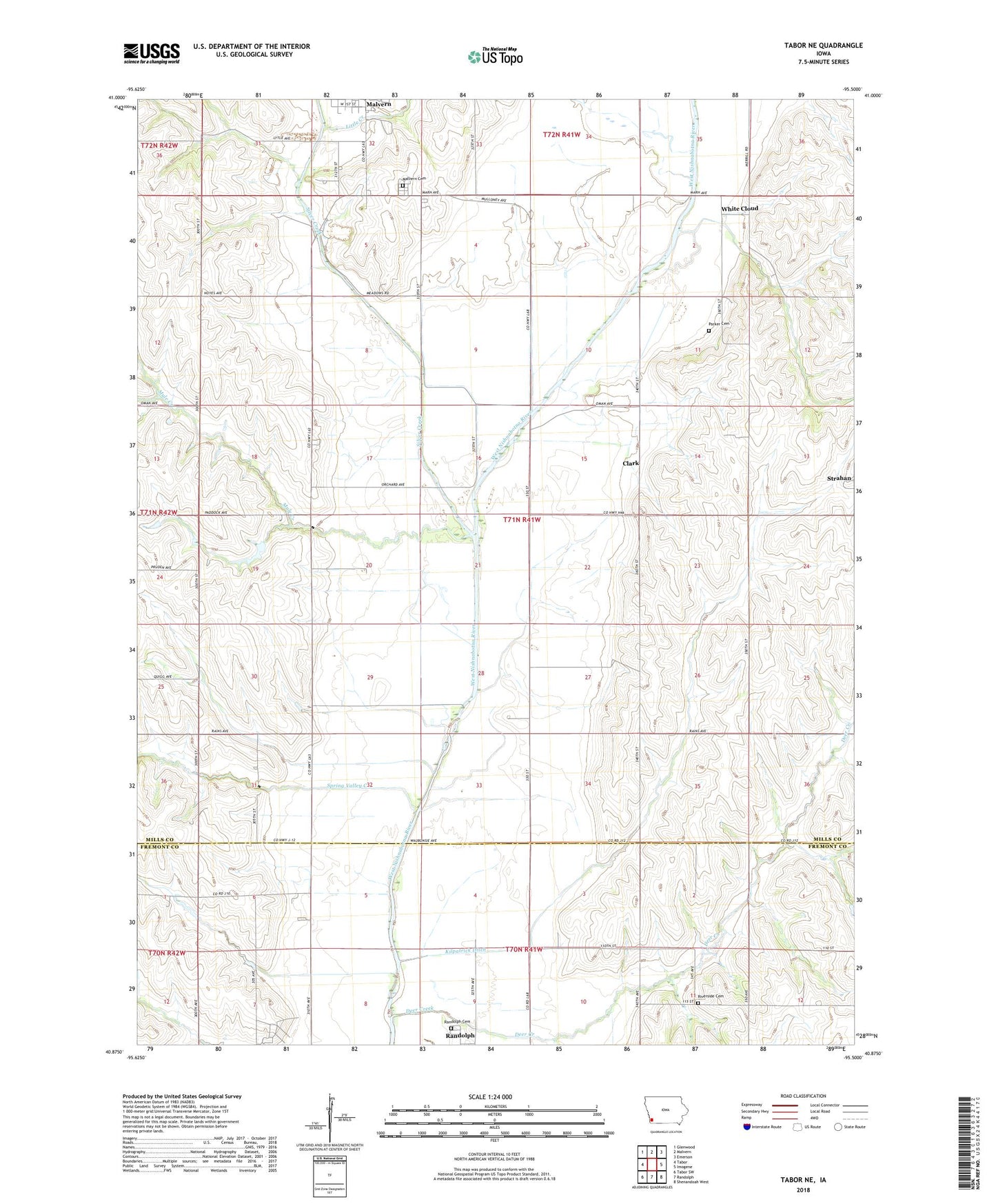
2022 topographic map quadrangle Tabor NE in the state of Iowa. Scale: 1:24000. Based on the newly updated USGS 7.5' US Topo map series, this map is in the following counties: Mills, Fremont. The map contains contour data, water features, and other items you are used to seeing on USGS maps, but also has updated roads and other features. This is the next generation of topographic maps. Printed on high-quality waterproof paper with UV fade-resistant inks.
Quads adjacent to this one:
West: Tabor
Northwest: Glenwood
North: Malvern
Northeast: Emerson
East: Imogene
Southeast: Shenandoah West
South: Randolph
Southwest: Tabor SW
This map covers the same area as the classic USGS quad with code o40095h5.
Contains the following named places: Barrett School, Bass Landing Field, Clark, Clark Post Office, Deer Creek, Fairview Country Club, Foxworthy School, Gregory Feedlots, Kilpatrick Ditch, Little Creek, Malvern Cemetery, Mount Vernon School, Mule Creek, Parker Cemetery, Randolph Cemetery, Riverside Cemetery, Silver Creek, Spring Valley Creek, Spring Valley School, Strahan, Township of White Cloud, White Cloud, Whitecloud Post Office, ZIP Code: 51551