MyTopo
Farragut Iowa US Topo Map
Couldn't load pickup availability
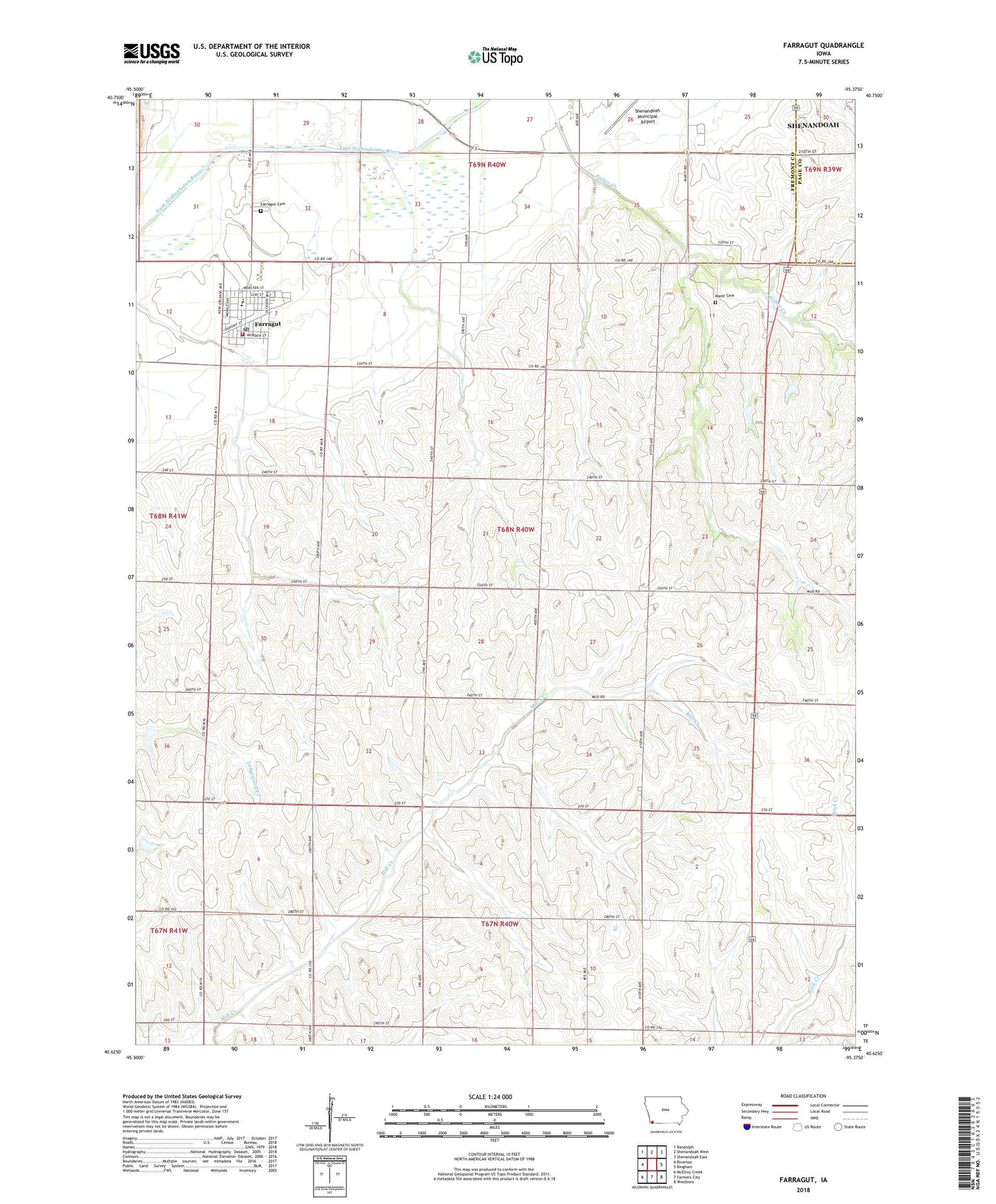
2022 topographic map quadrangle Farragut in the state of Iowa. Scale: 1:24000. Based on the newly updated USGS 7.5' US Topo map series, this map is in the following counties: Fremont, Page. The map contains contour data, water features, and other items you are used to seeing on USGS maps, but also has updated roads and other features. This is the next generation of topographic maps. Printed on high-quality waterproof paper with UV fade-resistant inks.
Quads adjacent to this one:
West: Riverton
Northwest: Randolph
North: Shenandoah West
Northeast: Shenandoah East
East: Bingham
Southeast: Westboro
South: Farmers City
Southwest: McElroy Creek
This map covers the same area as the classic USGS quad with code o40095f4.
Contains the following named places: American Legion Country Club, City of Farragut, Congregational United Church, Crestland Co-op Elevator, Farragut, Farragut Cemetery, Farragut City Hall, Farragut Elementary School, Farragut Fire and Rescue, Farragut Post Office, Manti, Manti Cemetery, Manti Cemetery - Off the Mormon Trail Historical Marker, Manti Memorial Park, Manti Post Office, Nishnabotna High School, Summit Church, Township of Fisher, United Methodist Church, ZIP Code: 51639