MyTopo
Smithland Iowa US Topo Map
Couldn't load pickup availability
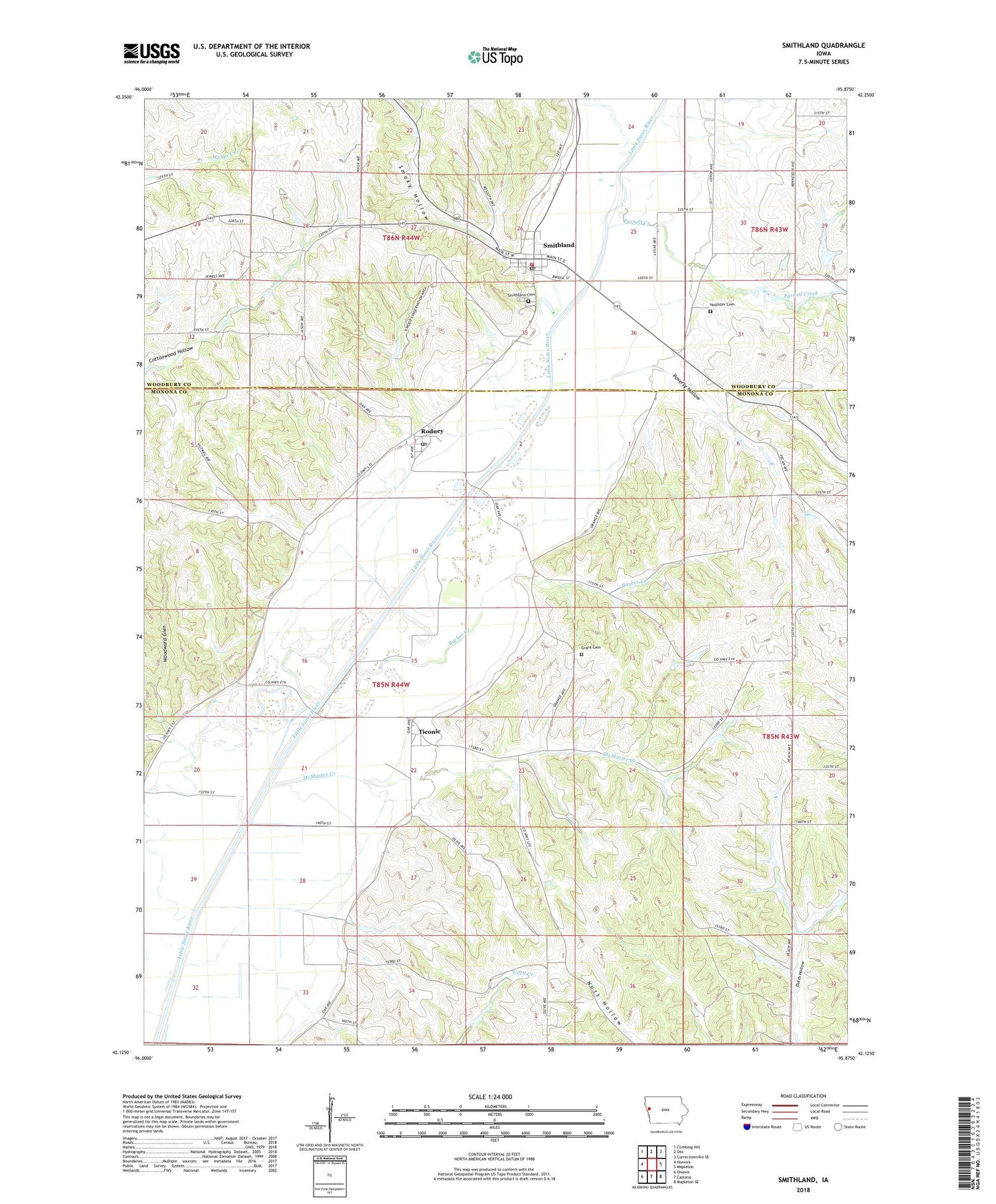
2022 topographic map quadrangle Smithland in the state of Iowa. Scale: 1:24000. Based on the newly updated USGS 7.5' US Topo map series, this map is in the following counties: Monona, Woodbury. The map contains contour data, water features, and other items you are used to seeing on USGS maps, but also has updated roads and other features. This is the next generation of topographic maps. Printed on high-quality waterproof paper with UV fade-resistant inks.
Quads adjacent to this one:
West: Hornick
Northwest: Climbing Hill
North: Oto
Northeast: Correctionville SE
East: Mapleton
Southeast: Mapleton SE
South: Castana
Southwest: Onawa
This map covers the same area as the classic USGS quad with code o42095b8.
Contains the following named places: Barber Creek, City of Rodney, City of Smithland, Grant Cemetery, Grant Center Post Office, Little Sioux Township Cemetery, Maynard Airport, McMaster Creek, Parnell Creek, Poverty Hollow, Rodney, Rodney City Hall, Rodney Pits Recreation Area, Rodney Post Office, Site of First School in Woodbury County Historical Marker, Smithland, Smithland City Hall, Smithland Fire Department, Smithland Post Office, Smoky Hollow, Ticonic, Ticonic Post Office, Township of Grant, United Church of Christ, United Methodist Church, Wellington Cemetery, Whiting Woods Recreation Area, Woodward Glen, ZIP Codes: 51051, 51056