MyTopo
Hornick Iowa US Topo Map
Couldn't load pickup availability
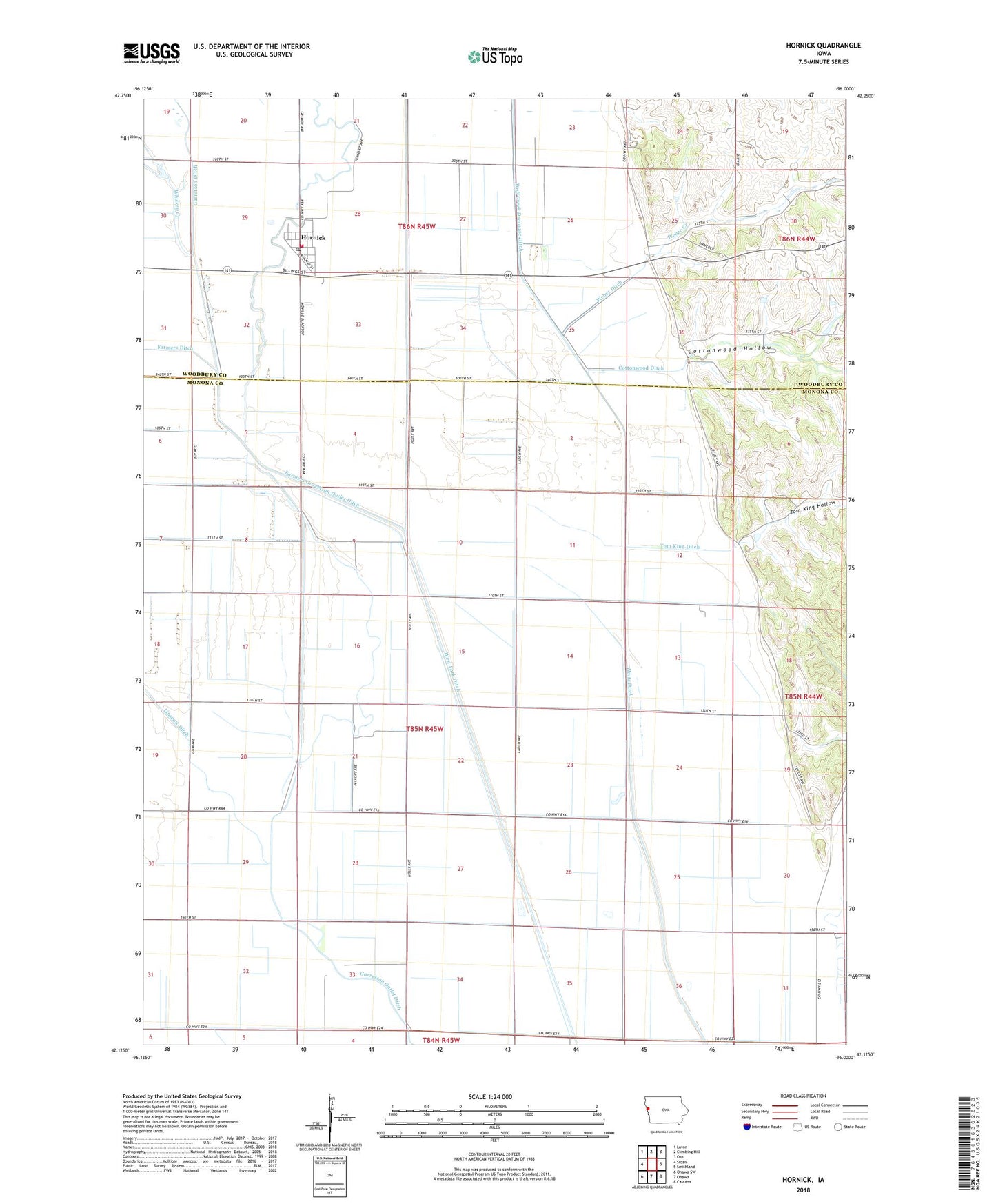
2022 topographic map quadrangle Hornick in the state of Iowa. Scale: 1:24000. Based on the newly updated USGS 7.5' US Topo map series, this map is in the following counties: Monona, Woodbury. The map contains contour data, water features, and other items you are used to seeing on USGS maps, but also has updated roads and other features. This is the next generation of topographic maps. Printed on high-quality waterproof paper with UV fade-resistant inks.
Quads adjacent to this one:
West: Sloan
Northwest: Luton
North: Climbing Hill
Northeast: Oto
East: Smithland
Southeast: Castana
South: Onawa
Southwest: Onawa SW
This map covers the same area as the classic USGS quad with code o42096b1.
Contains the following named places: City of Hornick, Cottonwood Ditch, Cottonwood Hollow, Farmers Ditch, Farmers Garretson Outlet Ditch, First Baptist Church, Garretson Outlet Ditch, Grant Center, Haitz Ditch, Hornick, Hornick City Hall, Hornick Post Office, Hornick Volunteer Fire Department, Linscott Ditch, Saint John's Evangelical Church, Saint John's Lutheran Church, Tom King Ditch, Tom King Hollow, Township of West Fork, United Methodist Church, Weber Creek, Weber Ditch, West Fork Ditch, West Fork Little Sioux River, Whiskey Creek, Wolf Creek