MyTopo
Troy Mills Iowa US Topo Map
Couldn't load pickup availability
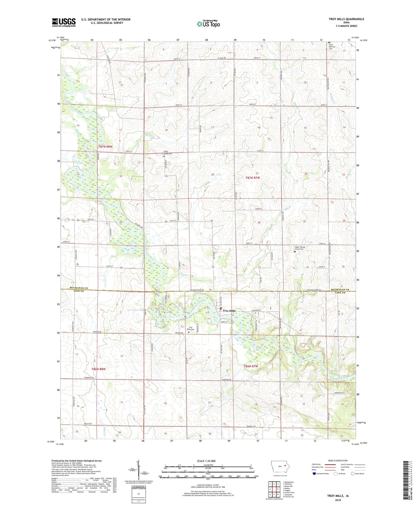
2022 topographic map quadrangle Troy Mills in the state of Iowa. Scale: 1:24000. Based on the newly updated USGS 7.5' US Topo map series, this map is in the following counties: Buchanan, Linn. The map contains contour data, water features, and other items you are used to seeing on USGS maps, but also has updated roads and other features. This is the next generation of topographic maps. Printed on high-quality waterproof paper with UV fade-resistant inks.
Quads adjacent to this one:
West: Walker
Northwest: Quasqueton
North: Winthrop
Northeast: Masonville
East: Coggon
Southeast: Central City
South: Lafayette
Southwest: Center Point
This map covers the same area as the classic USGS quad with code o42091c6.
Contains the following named places: Atlanta, Atlanta Post Office, Cana, Cana Post Office, Carson Landing Strip, Circle Grove Cemetery, Dry Creek, Honey Creek, Hoover Church, Hoover Wildlife Area, Newtonville, Newtonville Post Office, North Linn Elementary School, North Linn High School, North Linn Middle School, Saint Patrick Cemetery, Sand Creek, Sand Creek Access Area, Township of Newton, Township of Spring Grove, Troy Mills, Troy Mills Cemetery, Troy Mills Post Office, Troy Mills State Fish and Game Area, Troy Mills Volunteer Fire Department, Troy Mills Wapsie County Park, Upper Spring Grove Cemetery