
MyTopo
Central City Iowa US Topo Map
Couldn't load pickup availability
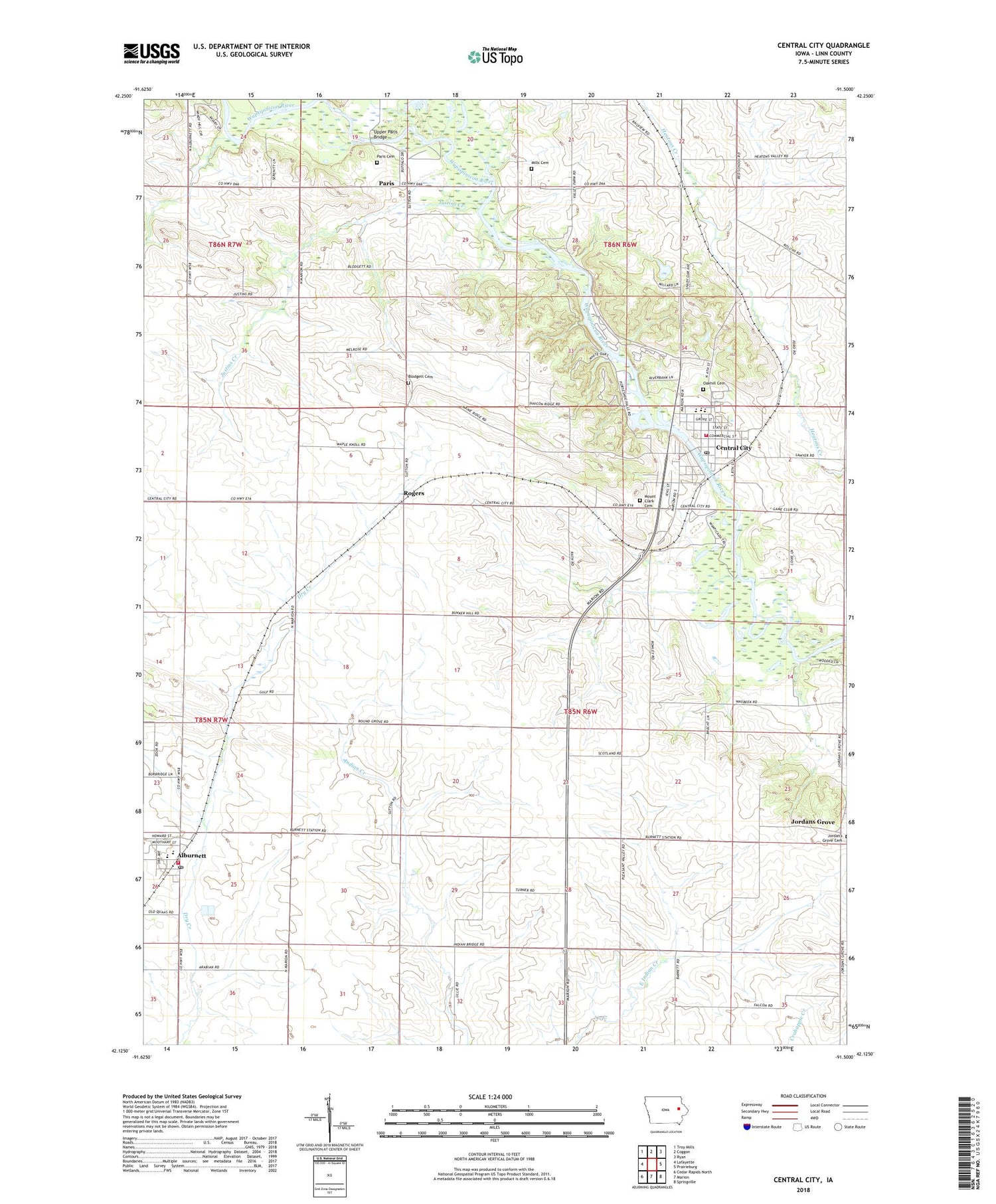
2022 topographic map quadrangle Central City in the state of Iowa. Scale: 1:24000. Based on the newly updated USGS 7.5' US Topo map series, this map is in the following counties: Linn. The map contains contour data, water features, and other items you are used to seeing on USGS maps, but also has updated roads and other features. This is the next generation of topographic maps. Printed on high-quality waterproof paper with UV fade-resistant inks.
Quads adjacent to this one:
West: Lafayette
Northwest: Troy Mills
North: Coggon
Northeast: Ryan
East: Prairieburg
Southeast: Springville
South: Marion
Southwest: Cedar Rapids North
This map covers the same area as the classic USGS quad with code o42091b5.
Contains the following named places: Alburnett, Alburnett - Otter Creek Fire Department, Alburnett City Hall, Alburnett Elementary School, Alburnett Post Office, Alburnett Senior High School, Alburnett United Methodist Church, Blodgett Cemetery, Central City, Central City Elementary School, Central City Fire Department, Central City Hall, Central City Middle / High School, Central City Middle School, Central City Post Office, Christian Church, City of Alburnett, City of Central City, Eakpicada County Park, Elmont Post Office, John C Clegg Library, Jordans Grove Cemetery, Justins Creek, Meadowview Country Club, Mills Grove Cemetery, Mount Clark Cemetery, Northeast Linn Ambulance Service, Oakhill Cemetery, Paris, Paris Cemetery, Paris Post Office, Petes Patch Airport, Pinicon Ridge County Park, Prairie Chapel Methodist Church, Rogers, Rogers Post Office, Saint Stephen's Catholic Church, Torah Post Office, Township of Maine, United Church of Christ, United Methodist Church, Upper Paris Bridge, Wakpicada County Park, Walton Creek, Wapsa, Wapsa Post Office, Wapsi Family Medical Center, Wassmer Landing Strip, ZIP Code: 52214


