MyTopo
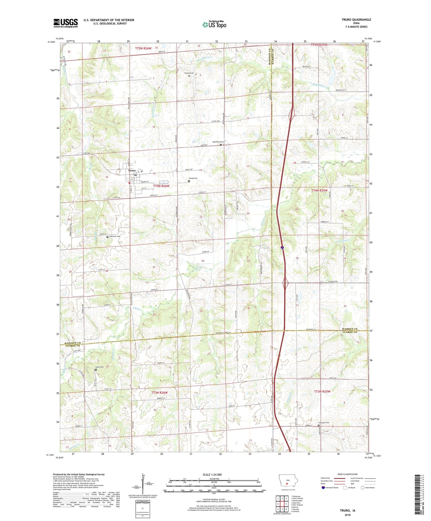
Truro Iowa US Topo Map
Couldn't load pickup availability
2022 topographic map quadrangle Truro in the state of Iowa. Scale: 1:24000. Based on the newly updated USGS 7.5' US Topo map series, this map is in the following counties: Madison, Clarke, Warren. The map contains contour data, water features, and other items you are used to seeing on USGS maps, but also has updated roads and other features. This is the next generation of topographic maps. Printed on high-quality waterproof paper with UV fade-resistant inks.
Quads adjacent to this one:
West: East Peru
Northwest: Patterson
North: Saint Charles
Northeast: Martensdale
East: New Virginia
Southeast: Jamison
South: Osceola
Southwest: Murray
This map covers the same area as the classic USGS quad with code o41093b7.
Contains the following named places: ADAPT Pre - School, Broadhorn Church, City of Truro, Congregational Christian Church, Dorrville Post Office, Farson Cemetery, Field Cemetery, Fremont Cemetery, Fremont Church, Green School, Hanner Creek, Hartman Cemetery, Hay Branch, Interstate 35 Elementary School, Interstate 35 Middle School, Interstate 35 Secondary School, Jones School, Limestone Creek, Prairie Grove Post Office, South River Field, Township of Ohio, Truro, Truro City Hall, Truro Fire and Rescue, Truro Post Office, Truro Public Library, United Methodist Church, Worthing Cemetery, Young Cemetery, ZIP Code: 50257