MyTopo
Martensdale Iowa US Topo Map
Couldn't load pickup availability
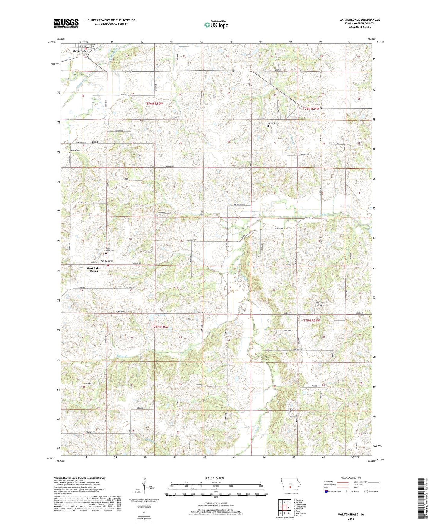
2022 topographic map quadrangle Martensdale in the state of Iowa. Scale: 1:24000. Based on the newly updated USGS 7.5' US Topo map series, this map is in the following counties: Warren. The map contains contour data, water features, and other items you are used to seeing on USGS maps, but also has updated roads and other features. This is the next generation of topographic maps. Printed on high-quality waterproof paper with UV fade-resistant inks.
Quads adjacent to this one:
West: Saint Charles
Northwest: Cumming
North: Norwalk
Northeast: Scotch Ridge
East: Indianola
Southeast: Medora
South: New Virginia
Southwest: Truro
This map covers the same area as the classic USGS quad with code o41093c6.
Contains the following named places: Center Chapel, Church of Christ, City of Martensdale, City of Saint Marys, Clanton Creek, Davis School, Immaculate Conception Church, Lake George, Latimer, Latimer Post Office, Mahaska County Hospital Heliport, Martensdale, Martensdale City Hall, Martensdale Community Church, Martensdale Fire and Rescue Department, Martensdale Post Office, Medford Post Office, Oswego Post Office, Painter Creek, Pleasant Hill Church, Reddish School, Saint Marys, Saint Marys Cemetery, Saint Marys Fire Department, Saint Marys Post Office, Saint Marys School - Martensdale, Saint Pauls Lutheran Church, Sants Branch, Too Short Airport, Township of Jackson, Turkey Creek, Wallace Cemetery, Warren Cemetery, Warren County Home, West Saint Marys, White Oak Point Post Office, White Oak School, Whitman School, Wick, Wick Post Office, ZIP Code: 50160