MyTopo
Union Center Iowa US Topo Map
Couldn't load pickup availability
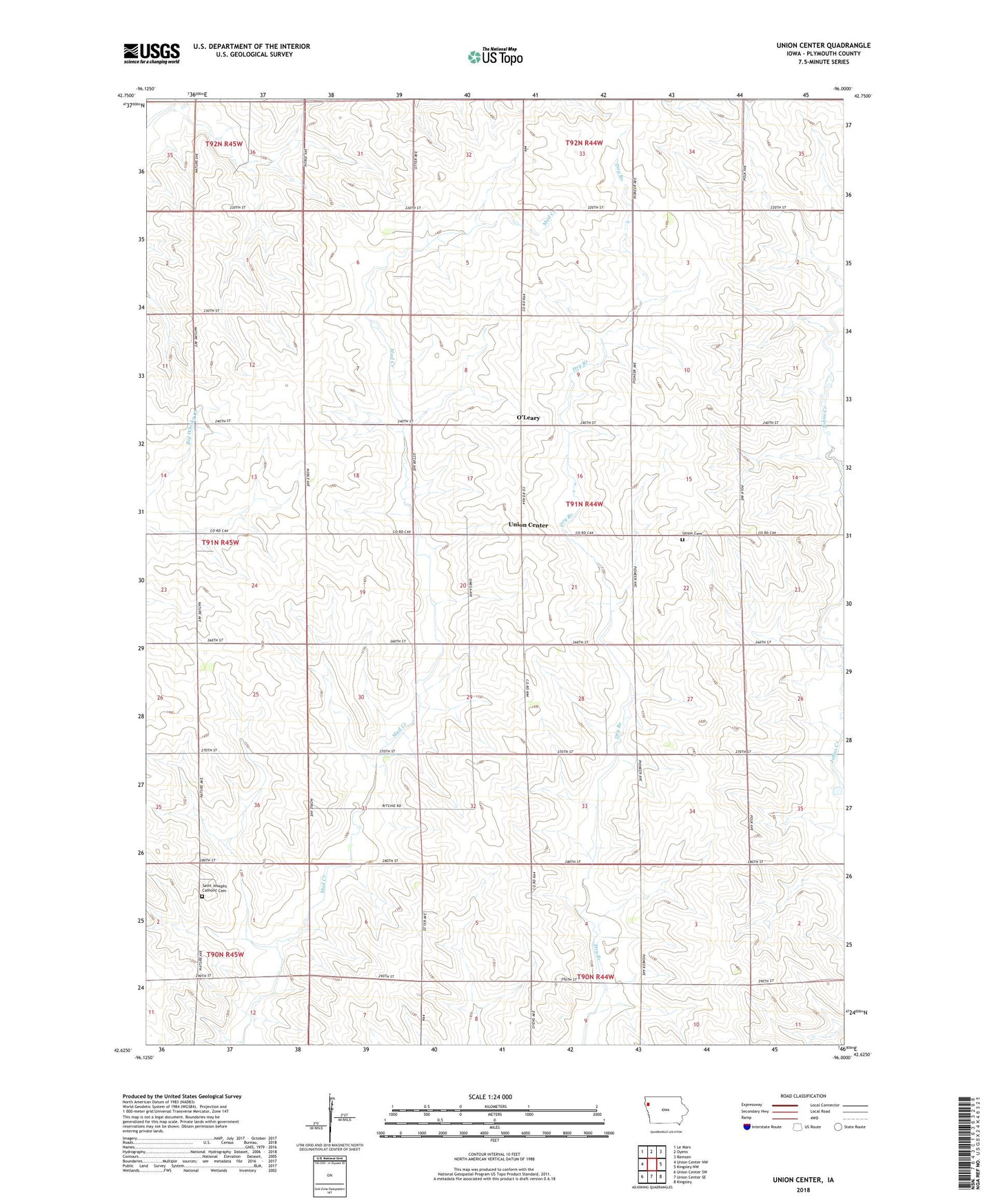
2022 topographic map quadrangle Union Center in the state of Iowa. Scale: 1:24000. Based on the newly updated USGS 7.5' US Topo map series, this map is in the following counties: Plymouth. The map contains contour data, water features, and other items you are used to seeing on USGS maps, but also has updated roads and other features. This is the next generation of topographic maps. Printed on high-quality waterproof paper with UV fade-resistant inks.
Quads adjacent to this one:
West: Union Center NW
Northwest: Le Mars
North: Oyens
Northeast: Remsen
East: Kingsley NW
Southeast: Kingsley
South: Union Center SE
Southwest: Union Center SW
This map covers the same area as the classic USGS quad with code o42096f1.
Contains the following named places: Longel Farms, North 40 Farms, O'Brien Prairie, O'Leary, O'Leary Post Office, R K Farms, Saint Joseph Cemetery, Saint Josephs Church, Schroeder Farm, Township of Union, Tri S Farm, Union Cemetery, Union Center, Union Church, Wright Farms