MyTopo
Remsen Iowa US Topo Map
Couldn't load pickup availability
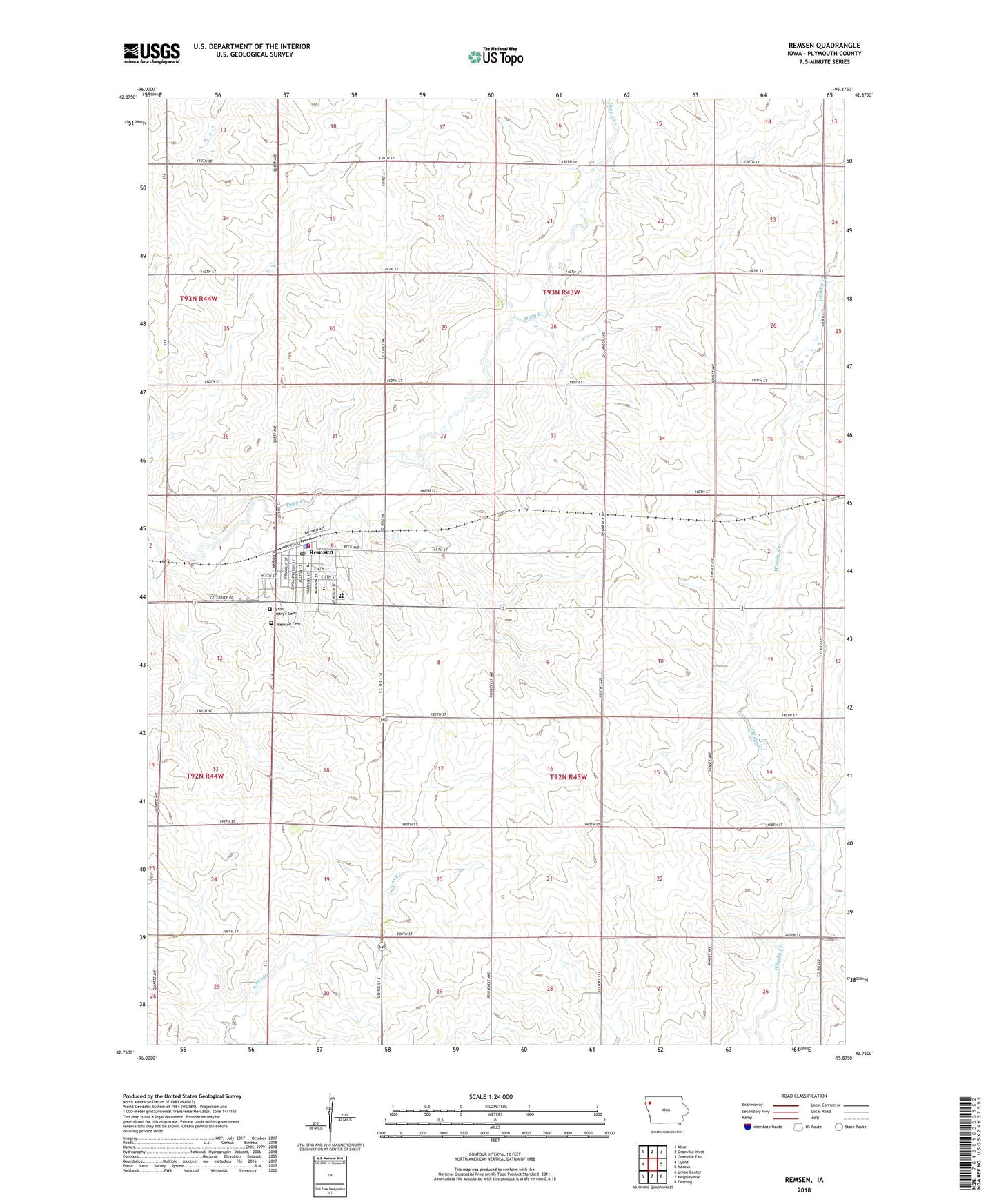
2022 topographic map quadrangle Remsen in the state of Iowa. Scale: 1:24000. Based on the newly updated USGS 7.5' US Topo map series, this map is in the following counties: Plymouth. The map contains contour data, water features, and other items you are used to seeing on USGS maps, but also has updated roads and other features. This is the next generation of topographic maps. Printed on high-quality waterproof paper with UV fade-resistant inks.
Quads adjacent to this one:
West: Oyens
Northwest: Alton
North: Granville West
Northeast: Granville East
East: Marcus
Southeast: Fielding
South: Kingsley NW
Southwest: Union Center
This map covers the same area as the classic USGS quad with code o42095g8.
Contains the following named places: Allen Farms, Arens Farm, Beck Park, Christ Lutheran Church, City of Remsen, Farmers Cooperative Elevator, Grove Meadow Farms, Happy Siesta Nursing Home, Homen Jersey Farm, J and G Farms, Meadow Wildlife Area, Medical Associates, MMCRU Middle School, MMCRU Remsen Elementary School, Remsen, Remsen - Union High School, Remsen Ambulance Service, Remsen Cemetery, Remsen Chiropractic Clinic, Remsen Dental Center, Remsen Fire Department, Remsen Golf Course, Remsen Post Office, Remsen Public Library, Ruden Farms, Saint Mary Grade School, Saint Mary's Cemetery, Saint Mary's High School, Saint Marys Roman Catholic Church, Saint Pauls Lutheran Church, Sunnyside Farm, Sunrise Park, Township of Meadow, Township of Remsen, ZIP Code: 51050