MyTopo
Prairie Rose Lake Iowa US Topo Map
Couldn't load pickup availability
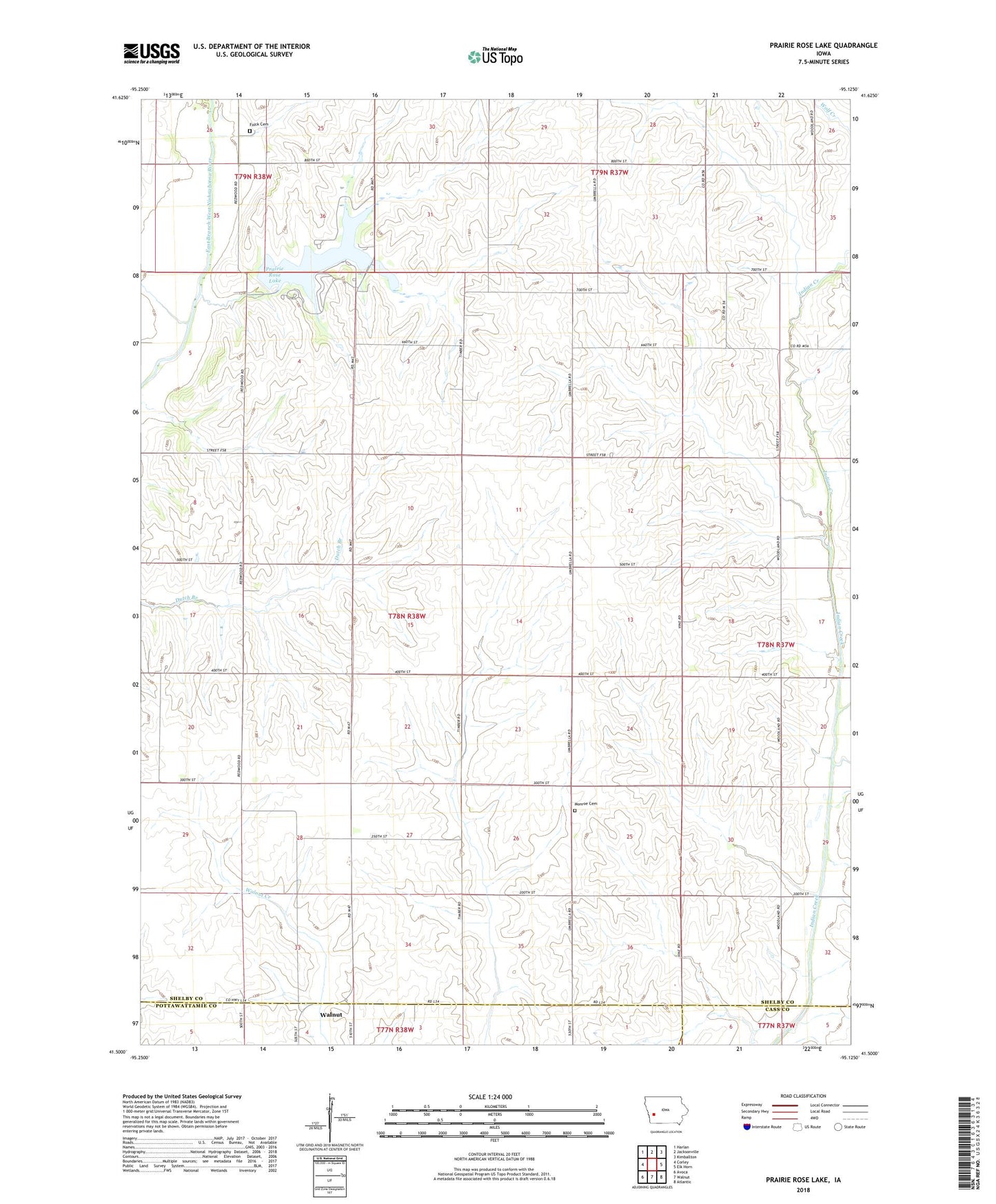
2023 topographic map quadrangle Prairie Rose Lake in the state of Iowa. Scale: 1:24000. Based on the newly updated USGS 7.5' US Topo map series, this map is in the following counties: Shelby, Pottawattamie, Cass. The map contains contour data, water features, and other items you are used to seeing on USGS maps, but also has updated roads and other features. This is the next generation of topographic maps. Printed on high-quality waterproof paper with UV fade-resistant inks.
Quads adjacent to this one:
West: Corley
Northwest: Harlan
North: Jacksonville
Northeast: Kimballton
East: Elk Horn
Southeast: Atlantic
South: Walnut
Southwest: Avoca
This map covers the same area as the classic USGS quad with code o41095e2.
Contains the following named places: Elkhorn Creek, Folck Cemetery, Monroe Cemetery, Monroe Church, Oak Ridge Wildlife Area, Prairie Rose Lake, Prairie Rose Lake Dam, Prairie Rose Post Office, Prairie Rose State Park, Rorbeck, Rorbeck Post Office, Squaw Creek, Township of Monroe