MyTopo
Waukon NW Iowa US Topo Map
Couldn't load pickup availability
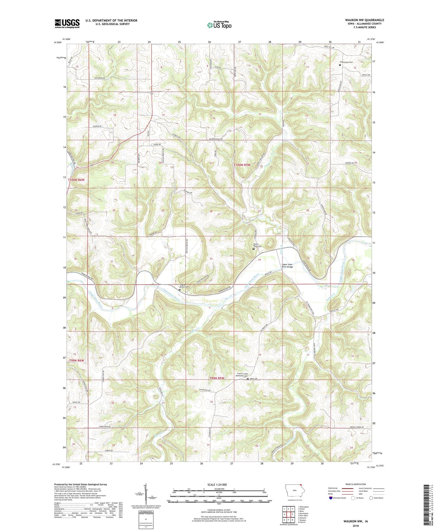
2022 topographic map quadrangle Waukon NW in the state of Iowa. Scale: 1:24000. Based on the newly updated USGS 7.5' US Topo map series, this map is in the following counties: Allamakee. The map contains contour data, water features, and other items you are used to seeing on USGS maps, but also has updated roads and other features. This is the next generation of topographic maps. Printed on high-quality waterproof paper with UV fade-resistant inks.
Quads adjacent to this one:
West: Dorchester
Northwest: Wilmington
North: Eitzen
Northeast: Reno
East: New Albin
Southeast: Church
South: Waukon
Southwest: Hanover
This map covers the same area as the classic USGS quad with code o43091d4.
Contains the following named places: Clear Creek, Clear Creek Post Office, Clear Creek Wildlife Management Area, English Bench Cemetery, French Creek, French Creek Methodist Cemetery, French Creek Post Office, French Creek Wildlife Management Area, Mount Hope Cemetery, Mount Hope Church, Rex Post Office, Saint Johns Church, Silver Creek, Township of French Creek, Township of Union City, Upper Iowa Canoe Access, Upper Iowa River Bridge, Wheatland Cemetery