MyTopo
New Albin Iowa US Topo Map
Couldn't load pickup availability
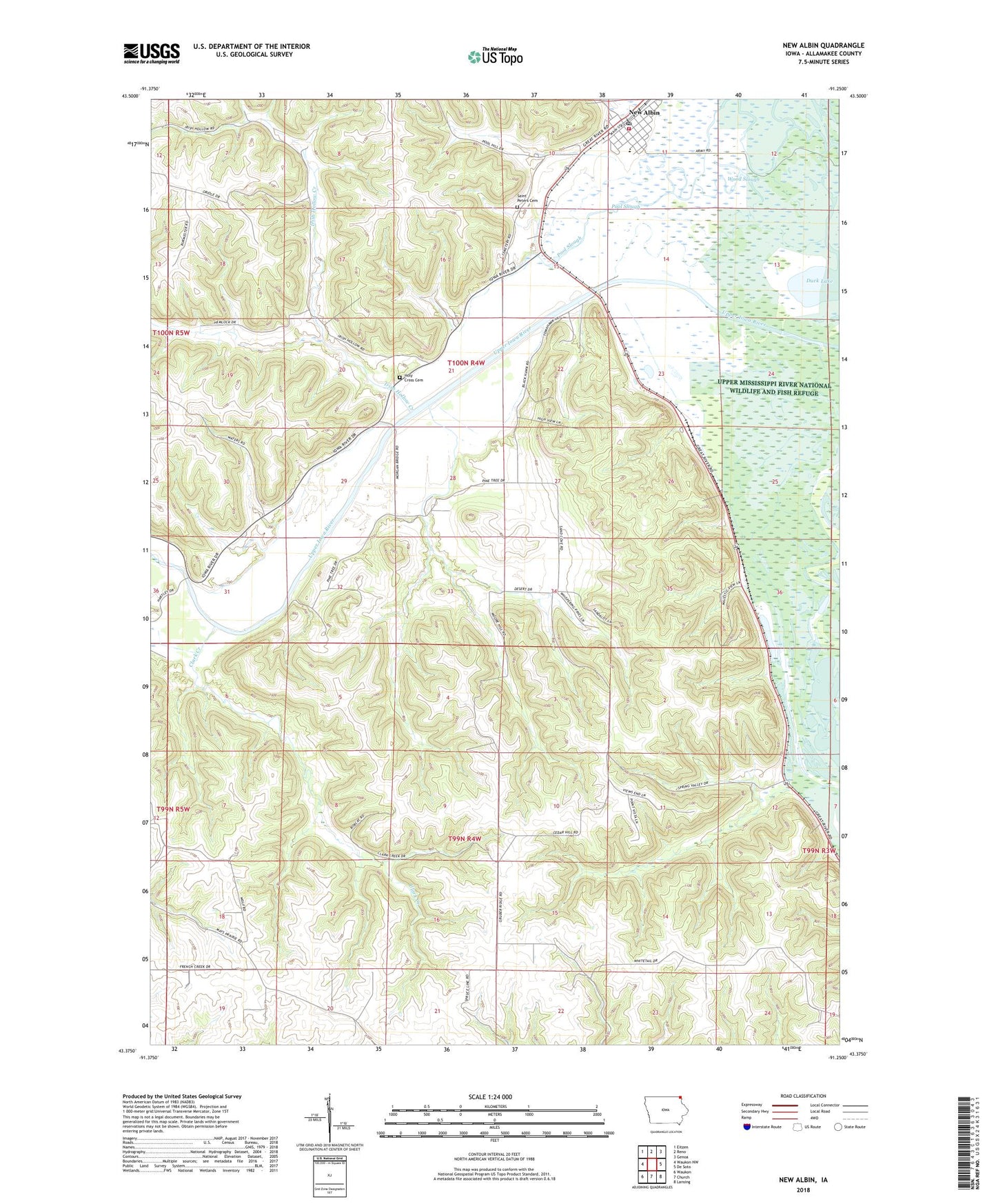
2022 topographic map quadrangle New Albin in the state of Iowa. Scale: 1:24000. Based on the newly updated USGS 7.5' US Topo map series, this map is in the following counties: Allamakee. The map contains contour data, water features, and other items you are used to seeing on USGS maps, but also has updated roads and other features. This is the next generation of topographic maps. Printed on high-quality waterproof paper with UV fade-resistant inks.
Quads adjacent to this one:
West: Waukon NW
Northwest: Eitzen
North: Reno
Northeast: Genoa
East: De Soto
Southeast: Lansing
South: Church
Southwest: Waukon
This map covers the same area as the classic USGS quad with code o43091d3.
Contains the following named places: Blackhawk Point Wildlife Management Area, City of New Albin, Clark Creek, Duck Lake, Fish Farms Mounds Wildlife Management Area, Grace United Methodist Church, Hayes Lake Roadside Park, Holy Cross Cemetery, Irish Hollow Creek, Kains Lake Wildlife Management Area, Kains Siding, Lansing Wildlife Management Area, New Albin, New Albin Big Lake Public Hunting Area, New Albin Big Lake Wildlife Management Area, New Albin Elementary School, New Albin Municipal Building, New Albin Police Department, New Albin Post Office, New Albin Volunteer Fire Department, Pool Slough, Pool Slough Wildlife Management Area, Saint Josephs Catholic Church, Saint Peters Memorial Cemetery, Township of Iowa, Township of Lansing, Wood Slough, ZIP Code: 52160