MyTopo
Eitzen Minnesota US Topo Map
Couldn't load pickup availability
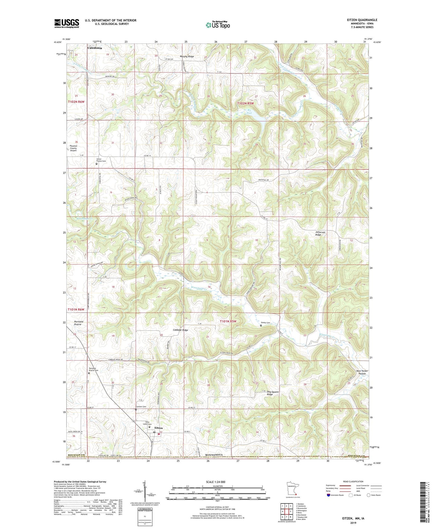
2022 topographic map quadrangle Eitzen in the state of Minnesota. Scale: 1:24000. Based on the newly updated USGS 7.5' US Topo map series, this map is in the following counties: Houston, Allamakee. The map contains contour data, water features, and other items you are used to seeing on USGS maps, but also has updated roads and other features. This is the next generation of topographic maps. Printed on high-quality waterproof paper with UV fade-resistant inks.
Quads adjacent to this one:
West: Wilmington
Northwest: Sheldon
North: Caledonia
Northeast: Brownsville
East: Reno
Southeast: New Albin
South: Waukon NW
Southwest: Dorchester
This map covers the same area as the classic USGS quad with code o43091e4.
Contains the following named places: Cabbage Ridge, Camp Winnebago, Carsten Cemetery, City of Eitzen, Crooked Creek S-3 Dam, Dog Square Ridge, Eitzen, Eitzen City Hall, Eitzen Fire Department, Eitzen Post Office, Grove Prairie Cemetery, Macal Grove Country Club, Murphy Ridge, New Yorker Hollow, North Fork Crooked Creek, Portland Prairie, Portland Prairie Cemetery, Portland Prairie Church, R3 Pool, R3 Structure Dam, Saint Lukes Cemetery, Saint Lukes Church, South Fork Crooked Creek, Steele Cemetery, Structure R-4 Dam, Township of Winnebago, Zion Lutheran Church, ZIP Code: 55931