MyTopo
Wellsburg Iowa US Topo Map
Couldn't load pickup availability
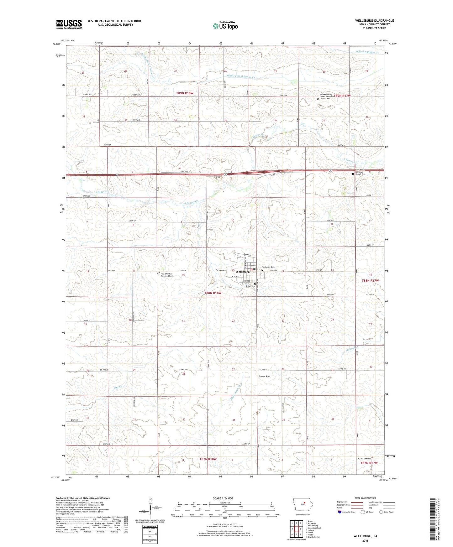
2022 topographic map quadrangle Wellsburg in the state of Iowa. Scale: 1:24000. Based on the newly updated USGS 7.5' US Topo map series, this map is in the following counties: Grundy. The map contains contour data, water features, and other items you are used to seeing on USGS maps, but also has updated roads and other features. This is the next generation of topographic maps. Printed on high-quality waterproof paper with UV fade-resistant inks.
Quads adjacent to this one:
West: Steamboat Rock
Northwest: Ackley
North: Aplington
Northeast: Parkersburg
East: Holland
Southeast: Grundy Center
South: Ivester
Southwest: Eldora
This map covers the same area as the classic USGS quad with code o42092d8.
Contains the following named places: AGWSR Wellsburg Center, City of Wellsburg, First Christian Reformed Cemetery, First Christian Reformed Church, Meadowbrook Golf Course, Palerno, Pleasant Valley U M C Church, Pleasant Valley United Methodist Church Cemetery, Saint John's Lutheran Church, Saint Paul's Church, Saint Paul's Lutheran Church Cemetery, Saint Peter's United Church, Shiloh Cemetery, Stoehr County Park, Timothy Christian School, Tower Rock, Township of Shiloh, United Reformed Church, Wellsburg, Wellsburg City Hall, Wellsburg Fire Department and Rescue, Wellsburg Post Office, Wellsburg Public Library, Wellsburg Reformed Church, Wellsburg Reformed Church Cemetery, ZIP Code: 50680