MyTopo
Grundy Center Iowa US Topo Map
Couldn't load pickup availability
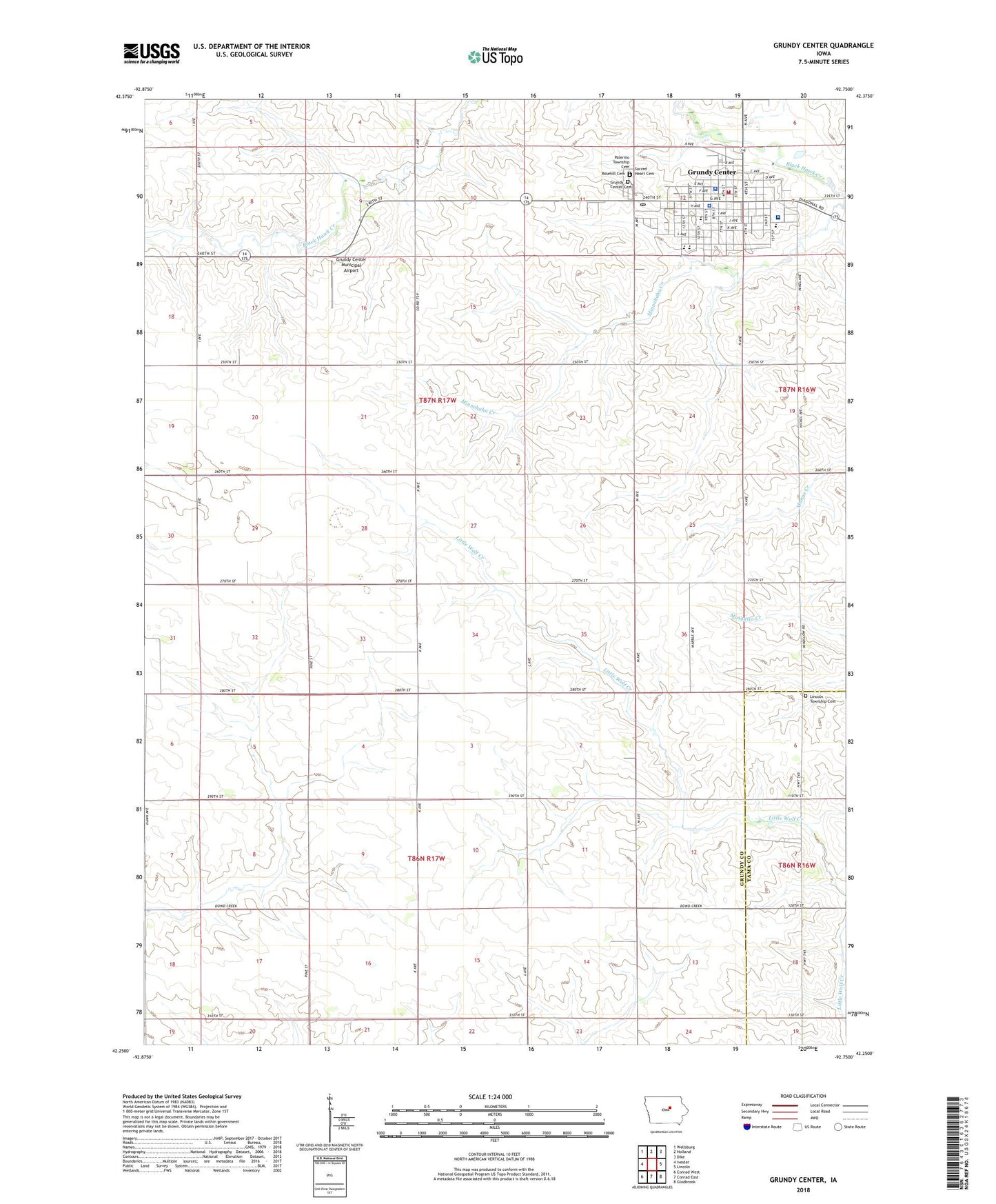
2022 topographic map quadrangle Grundy Center in the state of Iowa. Scale: 1:24000. Based on the newly updated USGS 7.5' US Topo map series, this map is in the following counties: Grundy, Tama. The map contains contour data, water features, and other items you are used to seeing on USGS maps, but also has updated roads and other features. This is the next generation of topographic maps. Printed on high-quality waterproof paper with UV fade-resistant inks.
Quads adjacent to this one:
West: Ivester
Northwest: Wellsburg
North: Holland
Northeast: Dike
East: Lincoln
Southeast: Gladbrook
South: Conrad East
Southwest: Conrad West
This map covers the same area as the classic USGS quad with code o42092c7.
Contains the following named places: Bethany Presbyterian Church, City of Grundy Center, Fairview Cemetery, Fifteen Mile Post Office, First Baptist Church, First Presbyterian Church, Grundy Care Center, Grundy Center, Grundy Center Ambulance Service, Grundy Center Cemetery, Grundy Center Elementary School, Grundy Center Fire Department, Grundy Center Learning Center, Grundy Center Library, Grundy Center Middle / High School, Grundy Center Middle School, Grundy Center Municipal Airport, Grundy Center Police Department, Grundy Center Post Office, Grundy City Hall, Grundy County Courthouse, Grundy County Memorial Hospital, Grundy County Sheriff's Office, Grundy Medical Center, Herbert Quick School, Herbert Quick Schoolhouse Historical Marker, Iowa Health Physicians Center, Lincoln Township Cemetery, Lutheran Church, Methodist Church, Orion Park, Rosehill Cemetery, Sacred Heart Catholic Church, Sacred Heart Cemetery, Town and Country Golf Club, Township of Clay, Township of Palermo, Upper Elementary School, ZIP Code: 50638