MyTopo
Parkersburg Iowa US Topo Map
Couldn't load pickup availability
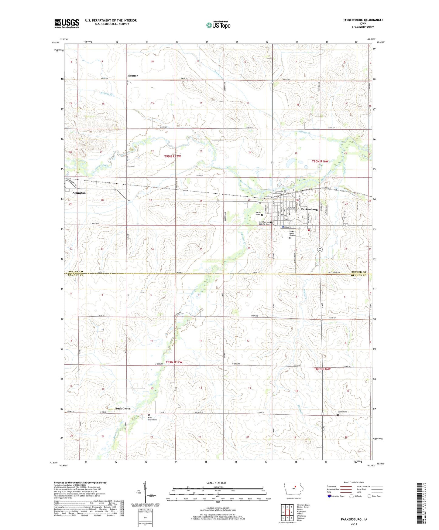
2022 topographic map quadrangle Parkersburg in the state of Iowa. Scale: 1:24000. Based on the newly updated USGS 7.5' US Topo map series, this map is in the following counties: Butler, Grundy. The map contains contour data, water features, and other items you are used to seeing on USGS maps, but also has updated roads and other features. This is the next generation of topographic maps. Printed on high-quality waterproof paper with UV fade-resistant inks.
Quads adjacent to this one:
West: Aplington
Northwest: Dumont South
North: Butler Center
Northeast: Coster
East: Stout
Southeast: Dike
South: Holland
Southwest: Wellsburg
This map covers the same area as the classic USGS quad with code o42092e7.
Contains the following named places: Aplington - Parkersburg High School, Beaver Meadows County Park, Beaver Meadows Golf Club, Behrends Cemetery, Bethel Lutheran Church, Buck Grove, Buck Grove Cemetery, Calvary Baptist Church, Christian Reformed Church, City of Parkersburg, Depot-Caboose Riverfront Park, Ed Thomas Field, Eleanor, Eleanor Post Office, Faith Lutheran Church, First Congregational Church, Hope Reformed Church, Johnson Creek, Kilsons Branch, Maple Manor, Oak Hill Cemetery, Parker Burial Grounds, Parkersburg, Parkersburg Ambulance Service, Parkersburg Chiropractic Clinic, Parkersburg City Hall, Parkersburg Elementary School, Parkersburg Family Dentistry Center, Parkersburg Fire Department, Parkersburg Historical Home, Parkersburg Medical Center, Parkersburg Police Department, Parkersburg Post Office, Parkersburg Public Library, Parkersburg United Methodist Church, Phelps Creek, Saint Patricks Catholic Cemetery, Saint Patricks Church, Salem Cemetery, Salem Church, South Beaver Creek, Township of Monroe, Township of Pleasant Valley, Wagoner Supply and Elevator Incorporated Elevator, ZIP Code: 50665