MyTopo
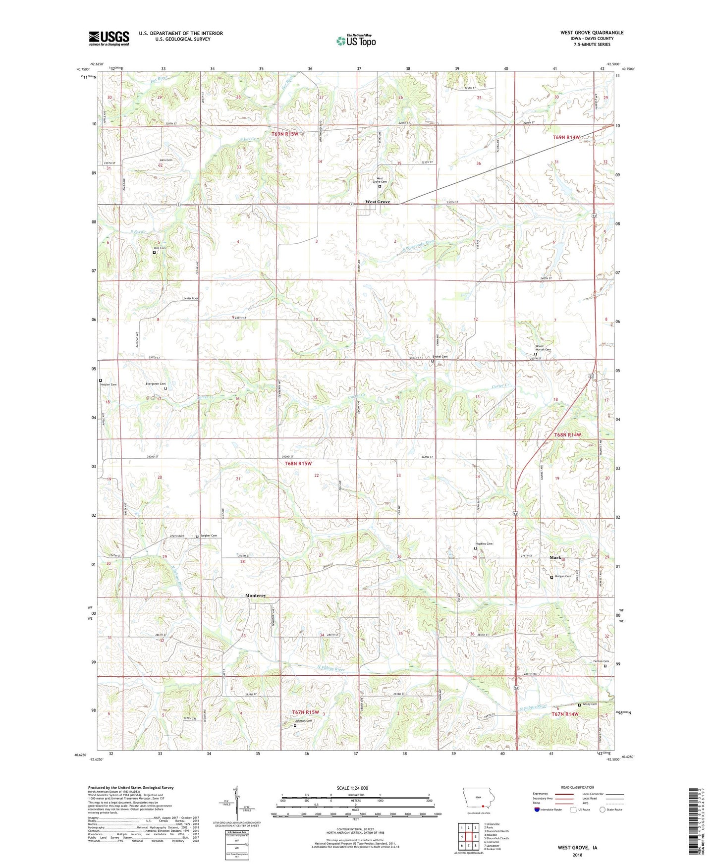
West Grove Iowa US Topo Map
Couldn't load pickup availability
2022 topographic map quadrangle West Grove in the state of Iowa. Scale: 1:24000. Based on the newly updated USGS 7.5' US Topo map series, this map is in the following counties: Davis. The map contains contour data, water features, and other items you are used to seeing on USGS maps, but also has updated roads and other features. This is the next generation of topographic maps. Printed on high-quality waterproof paper with UV fade-resistant inks.
Quads adjacent to this one:
West: Moulton
Northwest: Unionville
North: Paris
Northeast: Bloomfield North
East: Bloomfield South
Southeast: Bunker Hill
South: Lancaster
Southwest: Coatsville
This map covers the same area as the classic USGS quad with code o40092f5.
Contains the following named places: Bell Cemetery, Bethel Cemetery, Burgher Cemetery, Evergreen Cemetery, Fenton Cemetery, Hetzler Cemetery, Hopkins Cemetery, Jefferson Post Office, John Cemetery, Johnson Cemetery, Kelley Cemetery, Mark, Mark Church, Mark Post Office, Monterey, Monterey Christian Church, Monterey Post Office, Morgan Cemetery, Mount Moriah Cemetery, North Fabius Creek, Russellville, South Fox Creek, Township of Fabius, Township of West Grove, United Methodist Church, West Grove, West Grove Cemetery, West Grove County Park, West Grove Park, West Grove Post Office, Westgrove