MyTopo
Bunker Hill Missouri US Topo Map
Couldn't load pickup availability
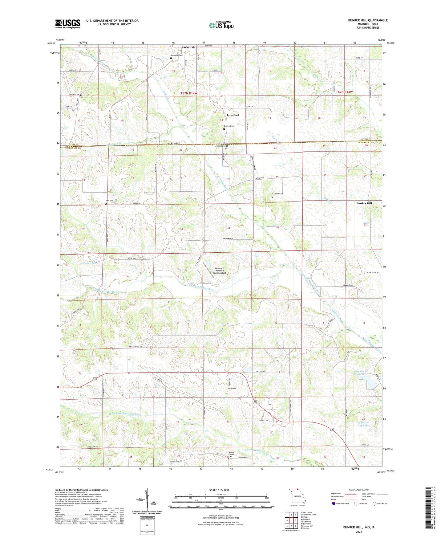
2021 topographic map quadrangle Bunker Hill in the states of Missouri, Iowa. Scale: 1:24000. Based on the newly updated USGS 7.5' US Topo map series, this map is in the following counties: Schuyler, Davis. The map contains contour data, water features, and other items you are used to seeing on USGS maps, but also has updated roads and other features. This is the next generation of topographic maps. Printed on high-quality waterproof paper with UV fade-resistant inks.
Quads adjacent to this one:
West: Lancaster
Northwest: West Grove
North: Bloomfield South
Northeast: Pulaski
East: Kilwinning
Southeast: Downing
South: Downing NW
Southwest: Queen City
This map covers the same area as the classic USGS quad with code o40092e4.
Contains the following named places: Batten Branch, Bridwell Cemetery, Brush Creek School, Bunker Hill, Darby Church, Del Norte Post Office, Donald Newcomb Lake, Downing City Lake, Downing City Lake Dam, Downing Reservoir, Dutchy School, Fabius Cemetery, Fabius Church, Fabius School, Gardner Cemetery, Howell Cemetery, Jaybird Darby School, Klondike Church, Lancaster City Lake, Lancaster City Lake Dam, Lunsford, Lunsford Post Office, New Zion Cemetery, New Zion School, Newcomb Dam - North Dam, Newcomb Dam - South Dam, Newcomb Hereford Ranch Airport, Norman Lake, Norman Lake Dam, Number 521 Dam, Number 524 Dam, Pleasant Grove Church, Reeves School, Savannah, Savannah Cemetery, Savannah Church, Savannah Post Office, Small Cemetery, South Fork North Fabius River, Township of Fabius, Vinita, Walker Chapel Cemetery, ZIP Code: 63548