MyTopo
West Point Iowa US Topo Map
Couldn't load pickup availability
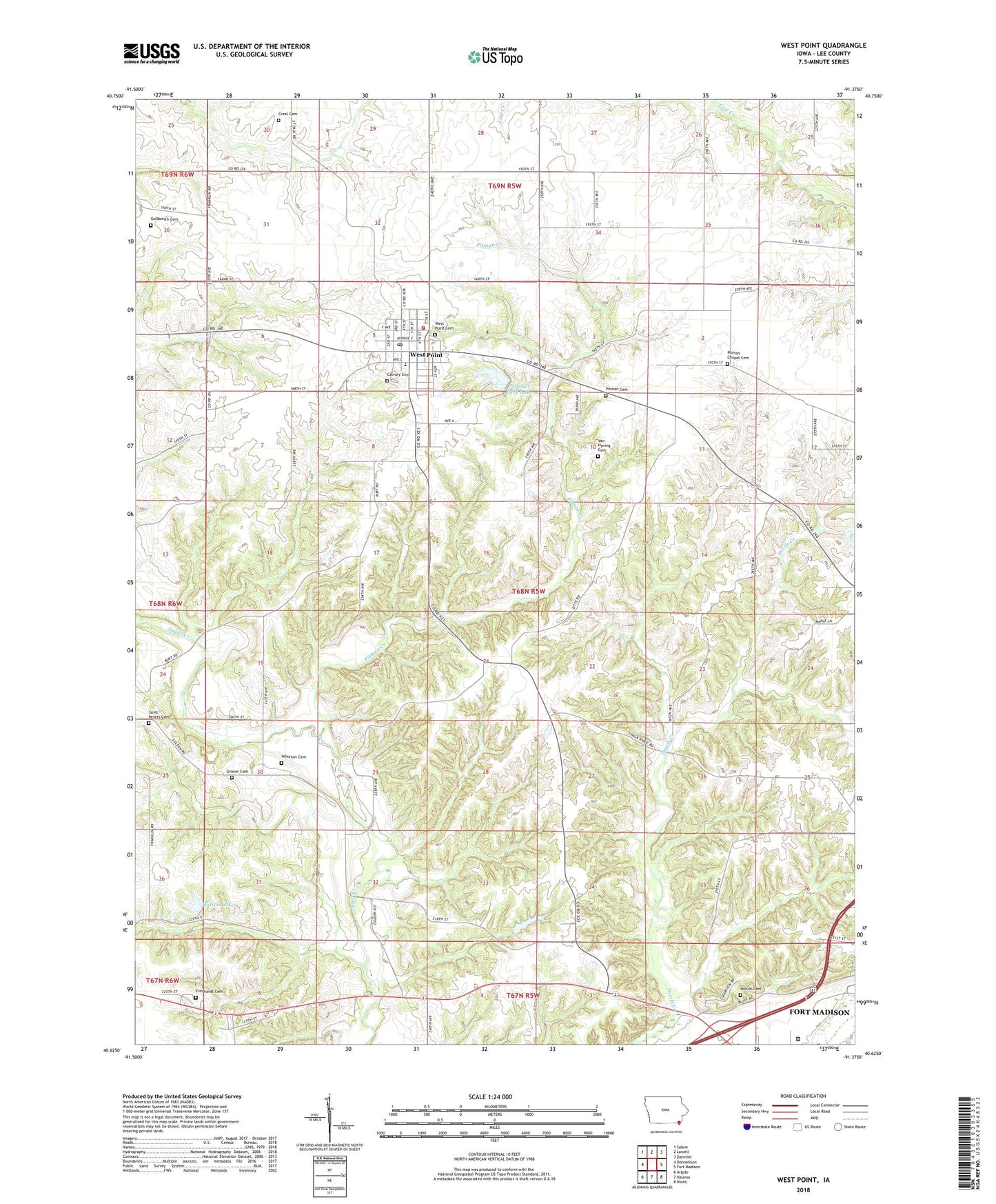
2022 topographic map quadrangle West Point in the state of Iowa. Scale: 1:24000. Based on the newly updated USGS 7.5' US Topo map series, this map is in the following counties: Lee. The map contains contour data, water features, and other items you are used to seeing on USGS maps, but also has updated roads and other features. This is the next generation of topographic maps. Printed on high-quality waterproof paper with UV fade-resistant inks.
Quads adjacent to this one:
West: Donnellson
Northwest: Salem
North: Lowell
Northeast: Danville
East: Fort Madison
Southeast: Niota
South: Nauvoo
Southwest: Argyle
This map covers the same area as the classic USGS quad with code o40091f4.
Contains the following named places: Air Evac Lifeteam 59, Calvary Cemetery, City of West Point, Creel Cemetery, Diamond B Raceway, Everhart Cemetery, Fort Madison Community Hospital, Goldsmith Cemetery, Graner Cemetery, Holy Trinity Elementary School, Lee County, Pitman Cemetery, Pitman Chapel Cemetery, Pitman Creek, Pollimer Park Lake, Pollimer Park Lake Dam, Pollmiller Park Trail, Saint Mary's Roman Catholic Church, Saint Peters Cemetery, Township of West Point, Van Hyning Cemetery, West Point, West Point Care Center, West Point Cemetery, West Point City Hall, West Point Clinic, West Point Feed and Grain Incorporated Elevator, West Point Fire and Rescue, West Point Optical Center, West Point Police Department, West Point Post Office, West Point Public Library, Whorton Cemetery, Wilson Cemetery, Wilson Lake, Wilson Lake Park, ZIP Code: 52656