MyTopo
Donnellson Iowa US Topo Map
Couldn't load pickup availability
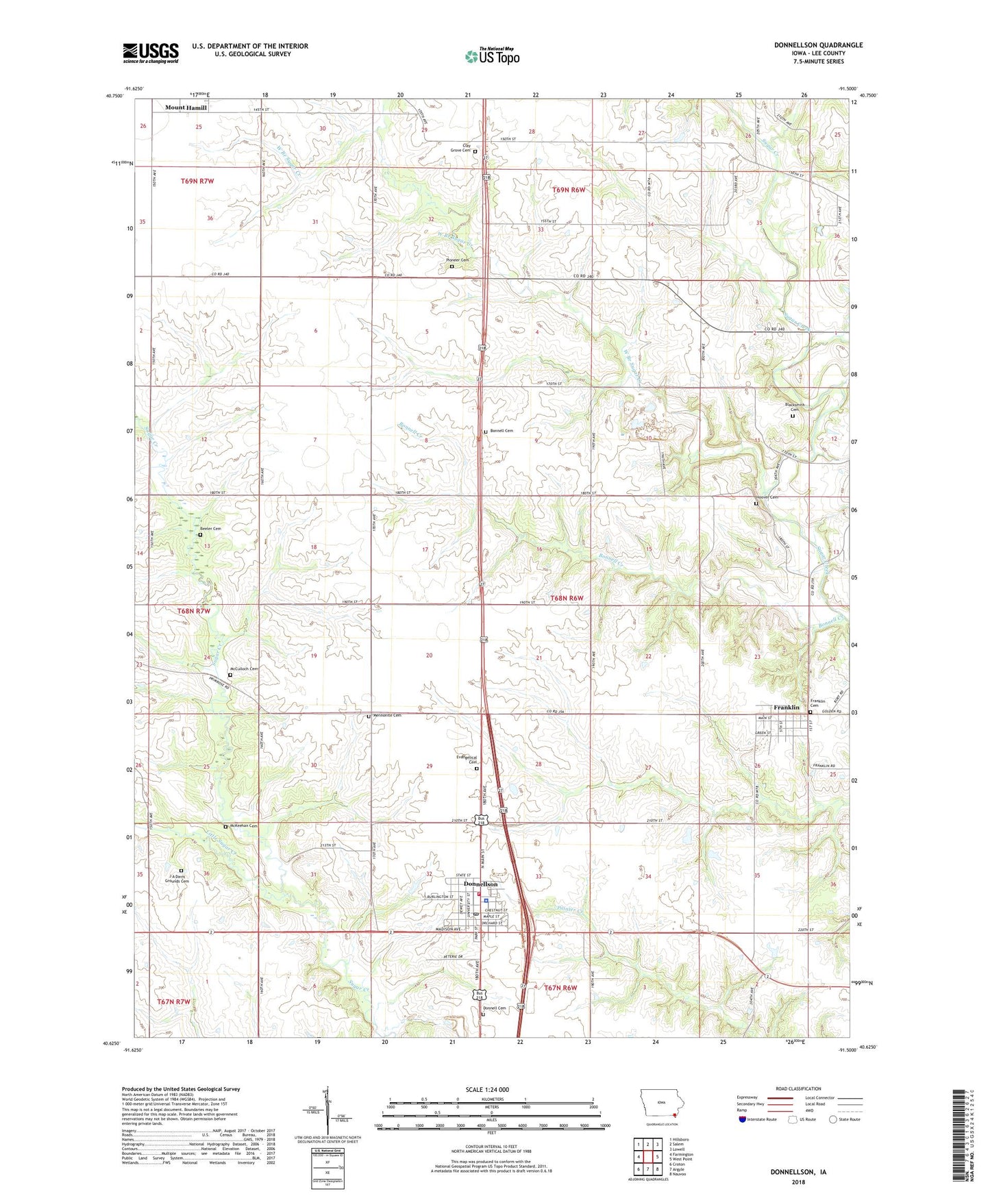
2022 topographic map quadrangle Donnellson in the state of Iowa. Scale: 1:24000. Based on the newly updated USGS 7.5' US Topo map series, this map is in the following counties: Lee. The map contains contour data, water features, and other items you are used to seeing on USGS maps, but also has updated roads and other features. This is the next generation of topographic maps. Printed on high-quality waterproof paper with UV fade-resistant inks.
Quads adjacent to this one:
West: Farmington
Northwest: Hillsboro
North: Salem
Northeast: Lowell
East: West Point
Southeast: Nauvoo
South: Argyle
Southwest: Croton
This map covers the same area as the classic USGS quad with code o40091f5.
Contains the following named places: Beeler Cemetery, Blacksmith Cemetery, Bonnell Creek, Busch Mennonite Cemetery, Christian Herschler Historic District Winery and Stagecoach Stop, City of Donnellson, City of Franklin, Clay Grove Cemetery, Clay-Grove Church, Clay's Grove Post Office, Donnell Cemetery, Donnellson, Donnellson Chiropractic Clinic, Donnellson City Hall, Donnellson City Library, Donnellson Elevator, Donnellson Fire Department, Donnellson Health Center, Donnellson Police Department, Donnellson Post Office, Donnellson Presbyterian Church, Dover Cemetery, Dover Post Office, Evangelical Cemetery, Franklin, Franklin Cemetery, Franklin Post Office, Franklin Station, Franklin Station Post Office, Green Acres Country Club, Hoover Cemetery, J A Davis Grounds Cemetery, La Crew, La Crew Post Office, Lacrew, Lee County Emergency Medical Services, Lee County Fairgrounds, Lee County Speedway, Little Sugar Creek, McCulloch Cemetery, McKeehan Cemetery, Pioneer Cemetery, Township of Franklin, United Church of Christ, United Methodist Church, Warren, Warren Post Office, West Branch Sugar Creek, Zion Mennonite Church, ZIP Code: 52625