MyTopo
Williamsburg NW Iowa US Topo Map
Couldn't load pickup availability
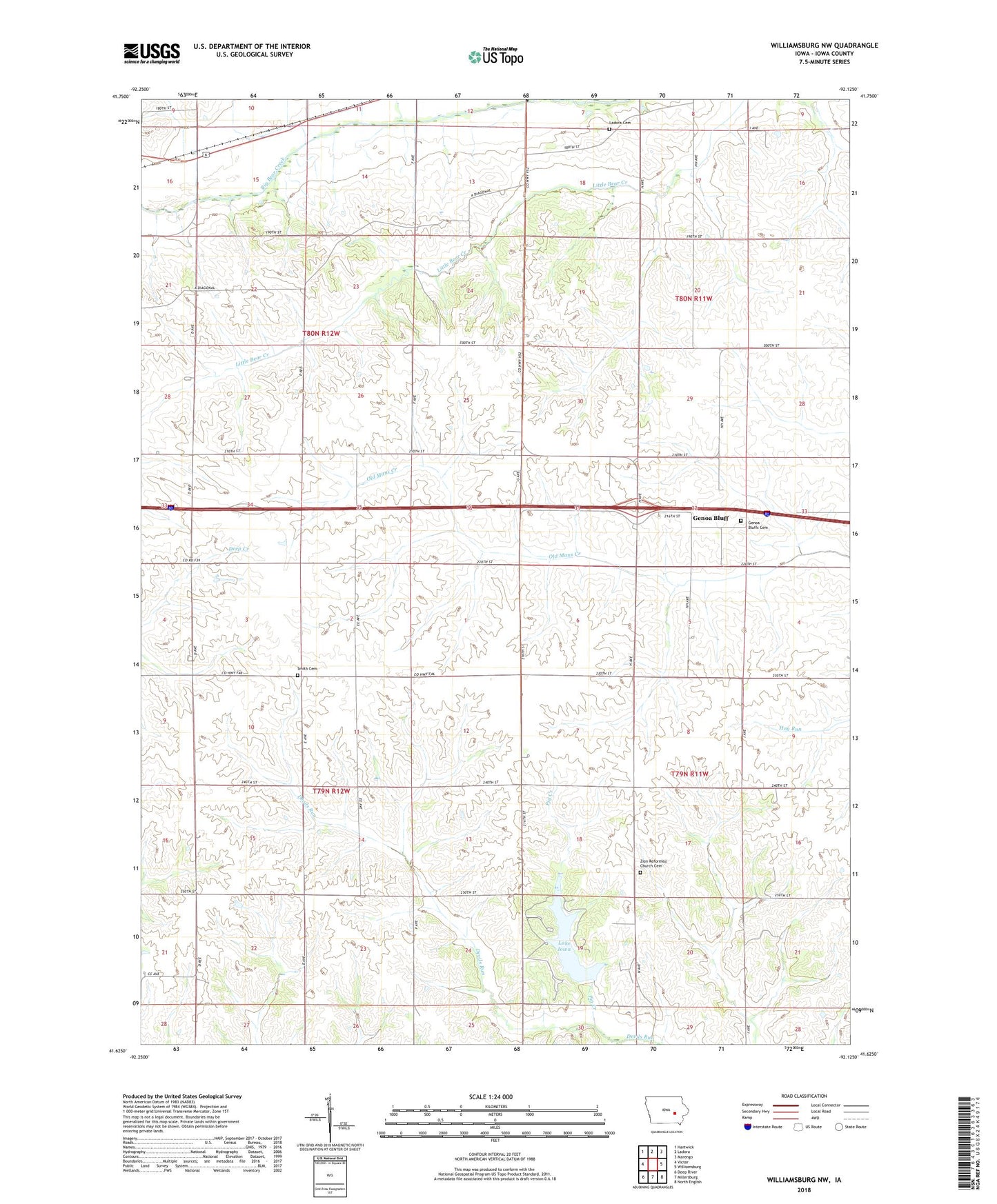
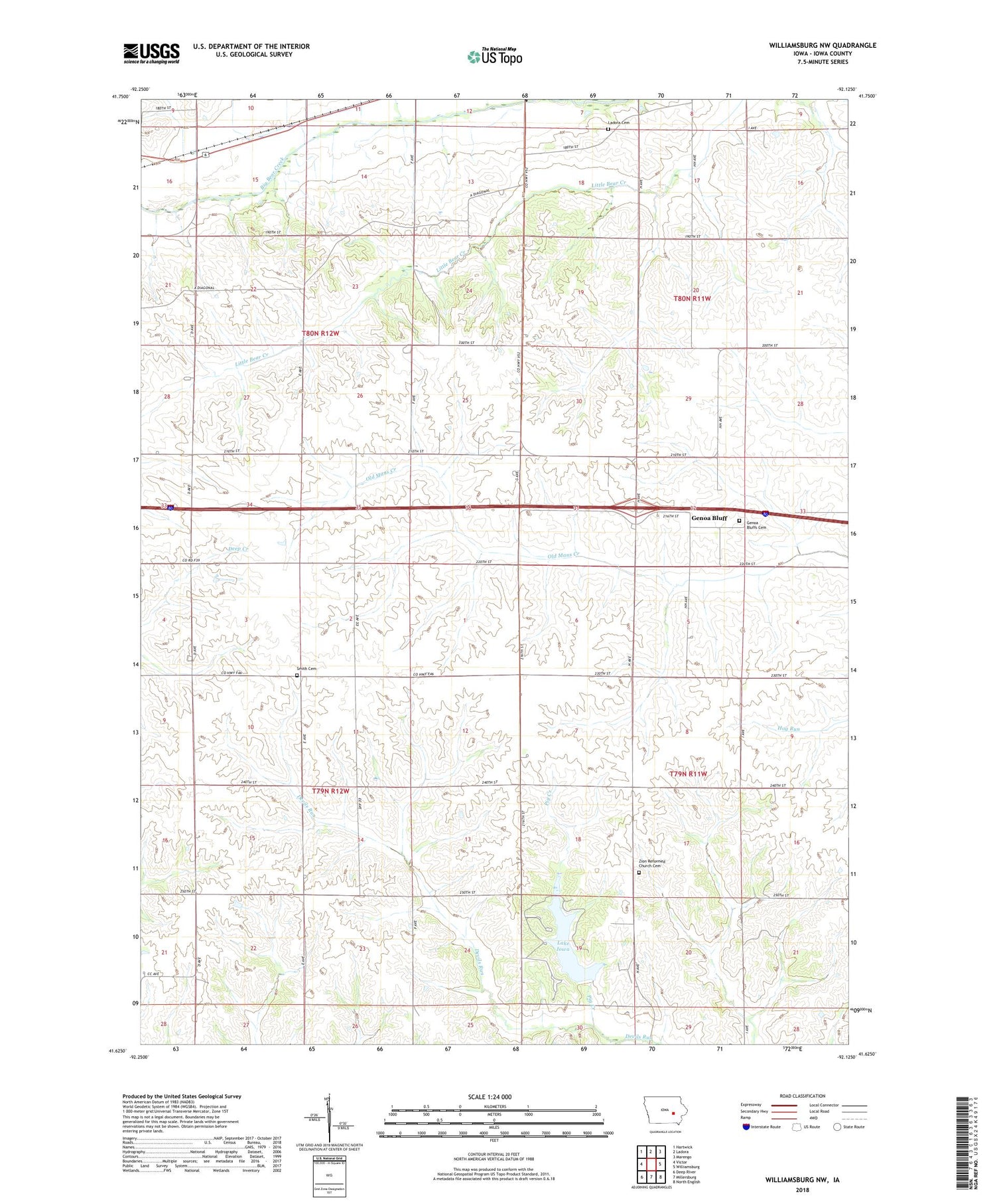
2022 topographic map quadrangle Williamsburg NW in the state of Iowa. Scale: 1:24000. Based on the newly updated USGS 7.5' US Topo map series, this map is in the following counties: Iowa. The map contains contour data, water features, and other items you are used to seeing on USGS maps, but also has updated roads and other features. This is the next generation of topographic maps. Printed on high-quality waterproof paper with UV fade-resistant inks.
Quads adjacent to this one:
West: Victor
Northwest: Hartwick
North: Ladora
Northeast: Marengo
East: Williamsburg
Southeast: North English
South: Millersburg
Southwest: Deep River
This map covers the same area as the classic USGS quad with code o41092f2.
Contains the following named places: Fundamental Gospel Church, Genoa Bluff, Genoa Bluff Post Office, Genoa Bluffs Cemetery, Historic Amana Colonies State Historical Marker, Iowa Lake Dam, Ladora Cemetery, Lake Iowa, Lake Iowa County Recreation Area, Ohio Church, Pig Creek, Smith Cemetery, Township of Hartford, Township of Lincoln, Victor East Bound Rest Area, Victor West Bound Rest Area, Zion Church, Zion Reformed Church Cemetery, ZIP Code: 52251