MyTopo
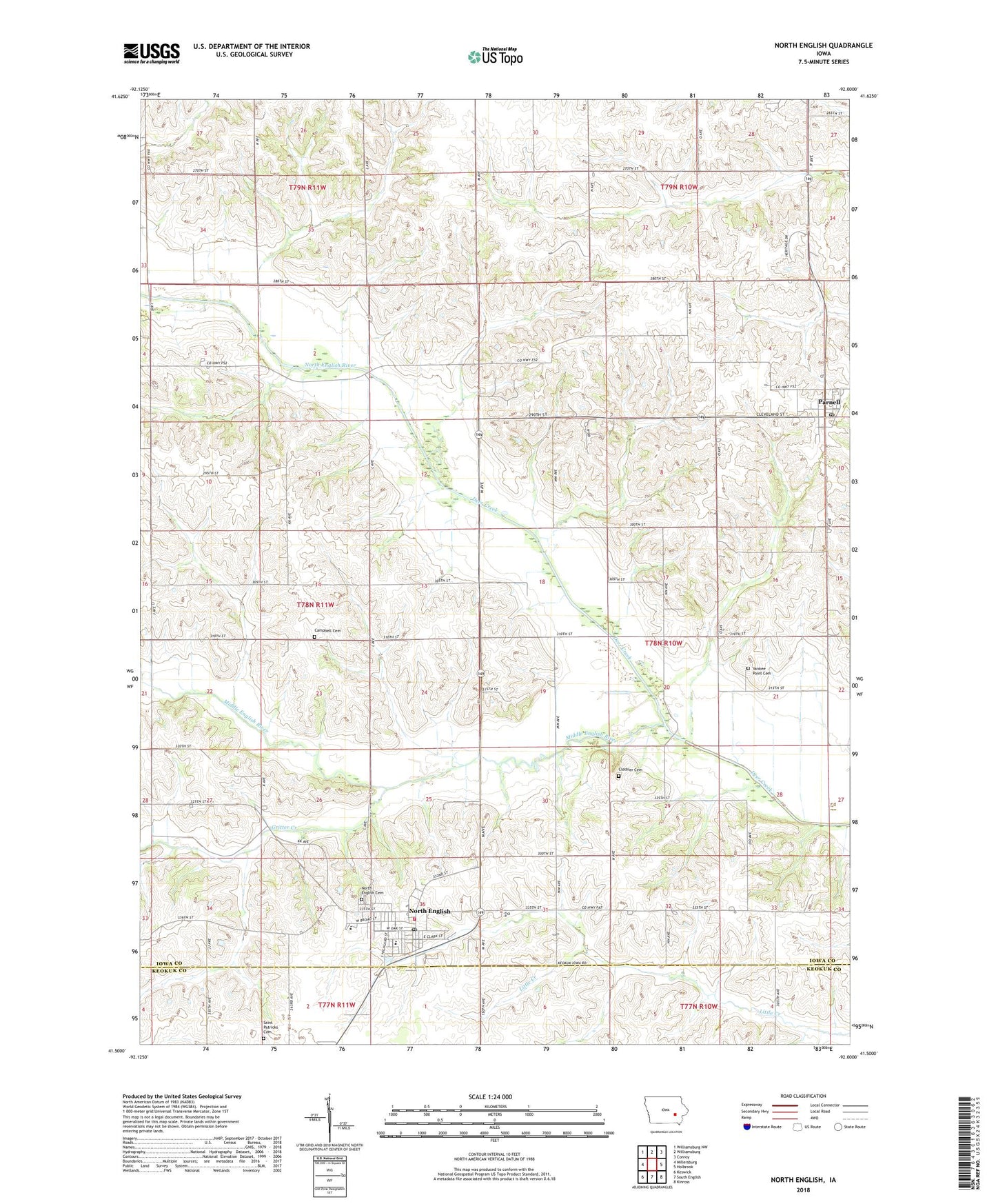
North English Iowa US Topo Map
Couldn't load pickup availability
2022 topographic map quadrangle North English in the state of Iowa. Scale: 1:24000. Based on the newly updated USGS 7.5' US Topo map series, this map is in the following counties: Iowa, Keokuk. The map contains contour data, water features, and other items you are used to seeing on USGS maps, but also has updated roads and other features. This is the next generation of topographic maps. Printed on high-quality waterproof paper with UV fade-resistant inks.
Quads adjacent to this one:
West: Millersburg
Northwest: Williamsburg NW
North: Williamsburg
Northeast: Conroy
East: Holbrook
Southeast: Kinross
South: South English
Southwest: Keswick
This map covers the same area as the classic USGS quad with code o41092e1.
Contains the following named places: Campbell Cemetery, Carter, Carter Post Office, Champion Hill Church, Christian Church, City of North English, City of Parnell, Clothier Cemetery, English Valley Nursing Care Center, English Valleys Elementary School, English Valleys Junior - Senior High School, First Baptist Church, Gritter Creek, Knoll Ridge Country Club, Methodist Church, Middle English River, North English, North English Cemetery, North English Family Practice Center, North English Fire Department, North English First Responders, North English Library, North English Post Office, Parnell, Parnell Post Office, Parnell Quick Response Service, Pleasant Grove Church, Saint Josephs Catholic Church, Saint Patricks Cemetery, Township of English, Township of Fillmore, Yankee Point Cemetery, ZIP Code: 52316