MyTopo
Ada Kansas US Topo Map
Couldn't load pickup availability
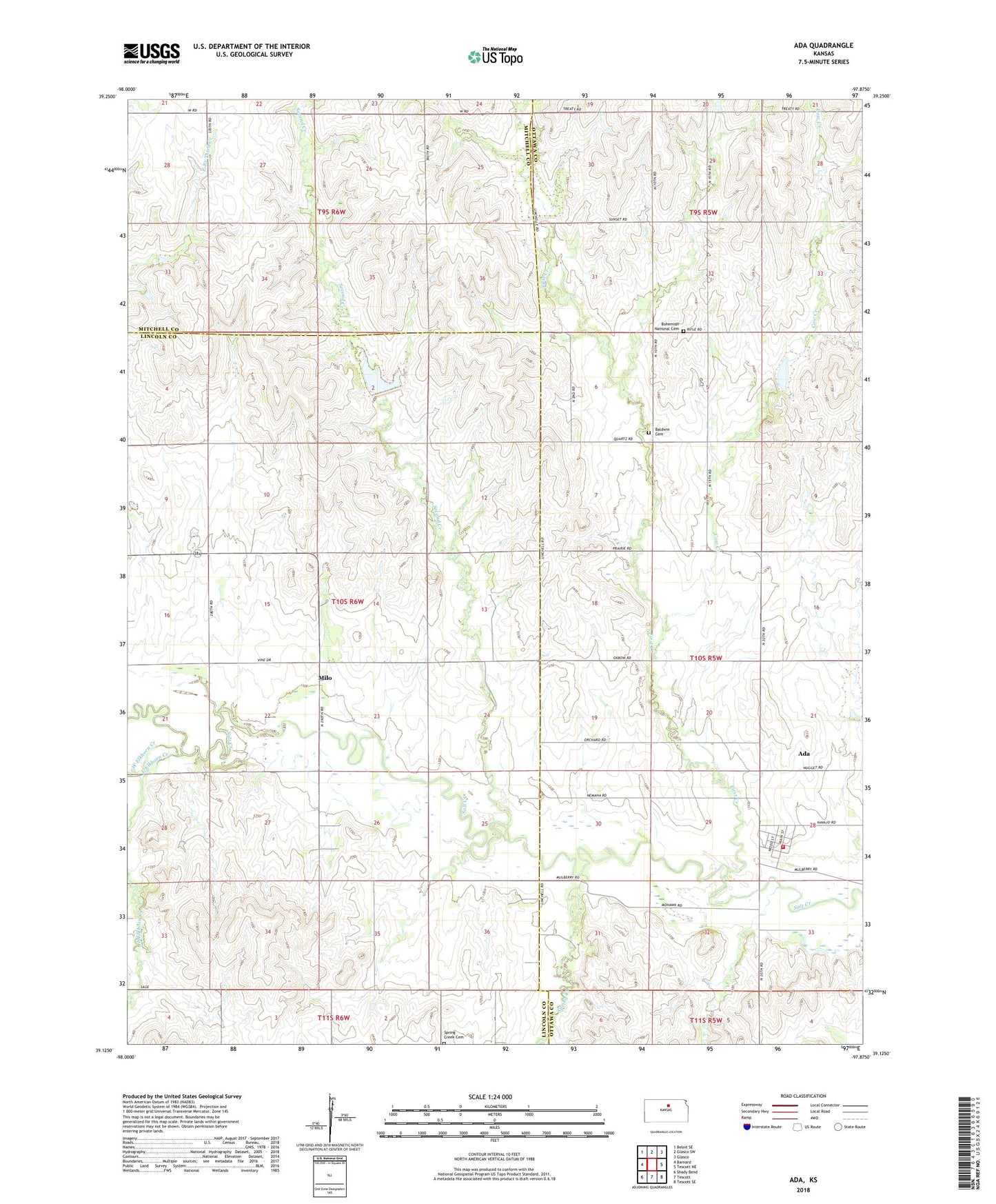
2022 topographic map quadrangle Ada in the state of Kansas. Scale: 1:24000. Based on the newly updated USGS 7.5' US Topo map series, this map is in the following counties: Lincoln, Ottawa, Mitchell. The map contains contour data, water features, and other items you are used to seeing on USGS maps, but also has updated roads and other features. This is the next generation of topographic maps. Printed on high-quality waterproof paper with UV fade-resistant inks.
Quads adjacent to this one:
West: Barnard
Northwest: Beloit SE
North: Glasco SW
Northeast: Glasco
East: Tescott NE
Southeast: Tescott SE
South: Tescott
Southwest: Shady Bend
This map covers the same area as the classic USGS quad with code o39097b8.
Contains the following named places: Ada, Ada Census Designated Place, Ada Grain Company Grain Elevator Number 1, Ada Ottawa Lincoln Fire Station 1, Ada United Methodist Church, Antioch Baptist Church, Baldwin Cemetery, Bohemain National Cemetery, Bohemian National Cemetery, Cow Creek, East Elkhorn Creek, First Creek, Luke Park, Milo, Second Creek, Spring Creek, Spring Creek Cemetery, Township of Salt Creek, West Elkhorn Creek