MyTopo
Tescott Kansas US Topo Map
Couldn't load pickup availability
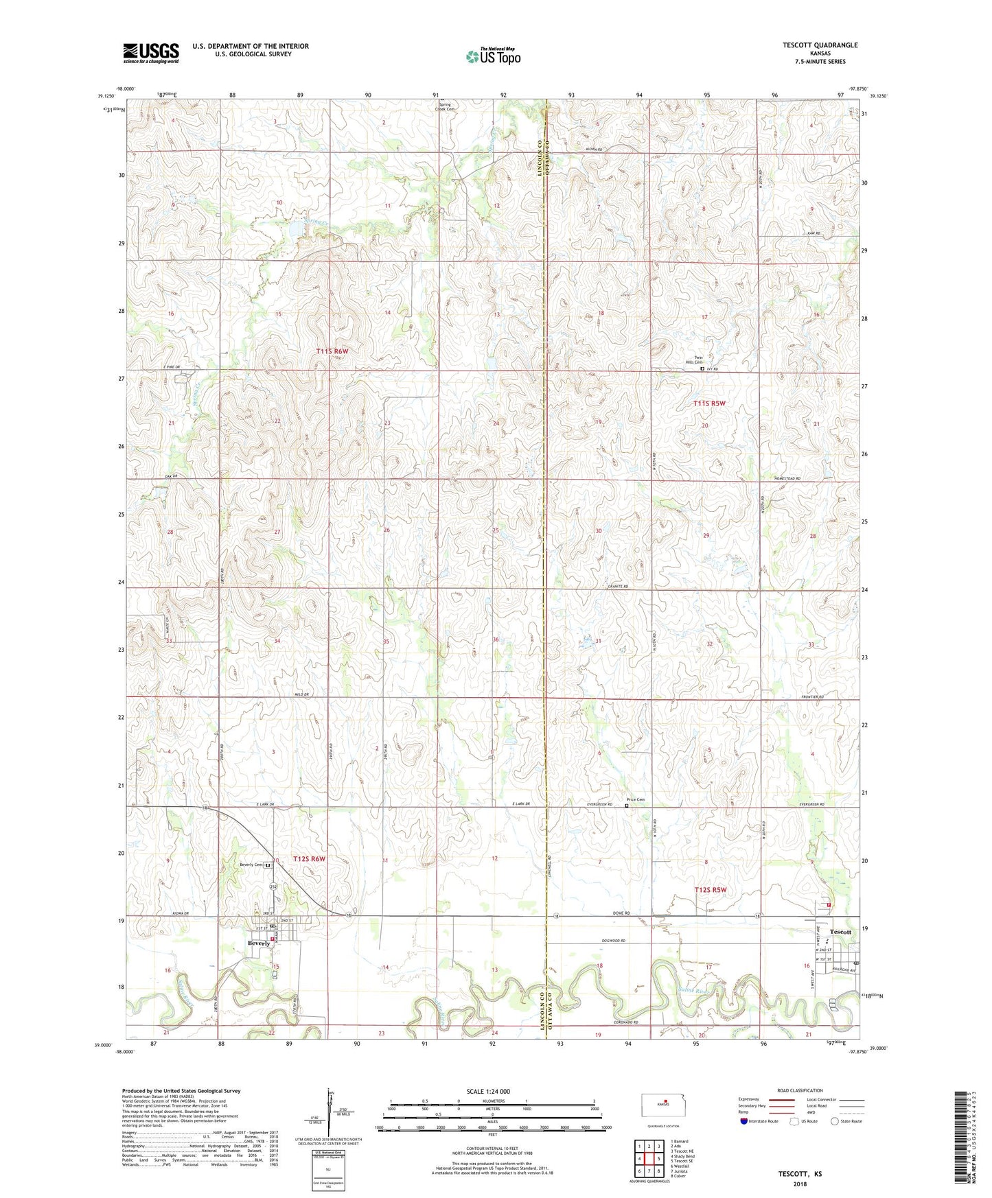
2022 topographic map quadrangle Tescott in the state of Kansas. Scale: 1:24000. Based on the newly updated USGS 7.5' US Topo map series, this map is in the following counties: Lincoln, Ottawa. The map contains contour data, water features, and other items you are used to seeing on USGS maps, but also has updated roads and other features. This is the next generation of topographic maps. Printed on high-quality waterproof paper with UV fade-resistant inks.
Quads adjacent to this one:
West: Shady Bend
Northwest: Barnard
North: Ada
Northeast: Tescott NE
East: Tescott SE
Southeast: Culver
South: Juniata
Southwest: Westfall
This map covers the same area as the classic USGS quad with code o39097a8.
Contains the following named places: Berkley Brothers Airport, Beverly, Beverly Cemetery, Beverly Community Church, Beverly Junior High School, Beverly Municipal Waste Treatment Plant, Beverly Post Office, Beverly Rural Fire Department, Beverly United Methodist Church, City of Beverly, City of Tescott, Hillbillies Airport, Ottawa County Rural Fire District 6 Tescott Station, Price Cemetery, Saint Paul Lutheran Church, Tescott, Tescott Elementary School, Tescott Junior / Senior High School, Tescott Municipal Wastewater Treatment Facility, Tescott Post Office, Tescott United Methodist Church, Township of Colorado, Township of Logan, Twin Hills Cemetery