MyTopo
Barnard Kansas US Topo Map
Couldn't load pickup availability
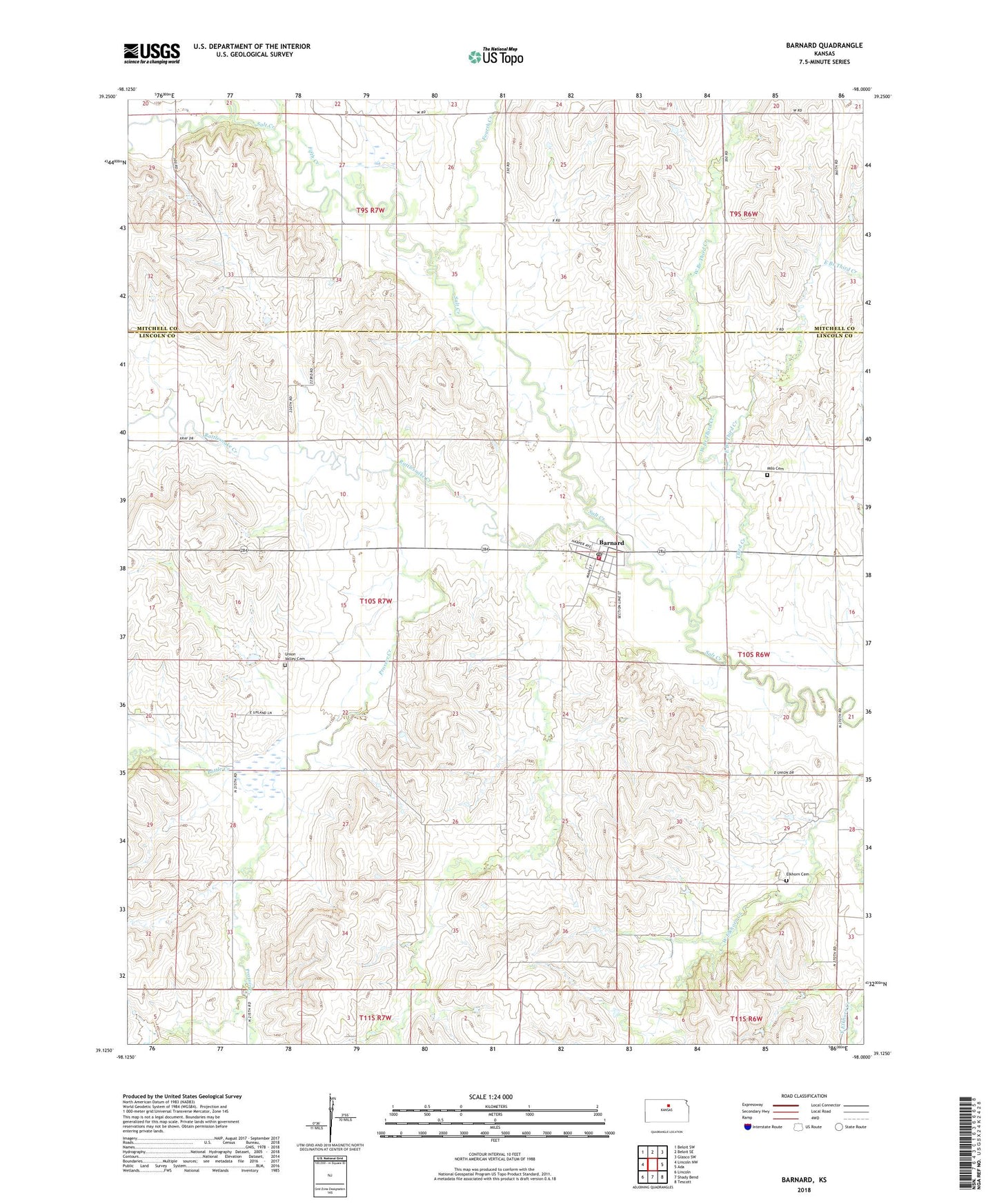
2022 topographic map quadrangle Barnard in the state of Kansas. Scale: 1:24000. Based on the newly updated USGS 7.5' US Topo map series, this map is in the following counties: Lincoln, Mitchell. The map contains contour data, water features, and other items you are used to seeing on USGS maps, but also has updated roads and other features. This is the next generation of topographic maps. Printed on high-quality waterproof paper with UV fade-resistant inks.
Quads adjacent to this one:
West: Lincoln NW
Northwest: Beloit SW
North: Beloit SE
Northeast: Glasco SW
East: Ada
Southeast: Tescott
South: Shady Bend
Southwest: Lincoln
This map covers the same area as the classic USGS quad with code o39098b1.
Contains the following named places: Barnard, Barnard Post Office, Barnard Rural Fire Department, Barnard United Methodist Church, Barnard Wastewater Plant, Battle Creek, City of Barnard, East Branch Third Creek, Elkhorn Cemetery, Fifth Creek, First Baptist Church, Fourth Creek, Milo Cemetery, Pinon, Prosser Creek, Rattlesnake Creek, Third Creek, Township of Scott, Union Valley Cemetery, West Branch Third Creek, Woodey, ZIP Code: 67418