MyTopo
Alden Kansas US Topo Map
Couldn't load pickup availability
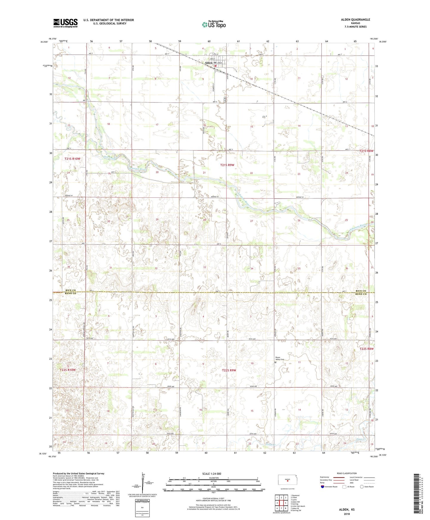
2022 topographic map quadrangle Alden in the state of Kansas. Scale: 1:24000. Based on the newly updated USGS 7.5' US Topo map series, this map is in the following counties: Rice, Reno. The map contains contour data, water features, and other items you are used to seeing on USGS maps, but also has updated roads and other features. This is the next generation of topographic maps. Printed on high-quality waterproof paper with UV fade-resistant inks.
Quads adjacent to this one:
West: Alden NW
Northwest: Raymond
North: Chase
Northeast: Lyons
East: Sterling
Southeast: Sterling SW
South: Alden SE
Southwest: Little Salt Marsh
This map covers the same area as the classic USGS quad with code o38098b3.
Contains the following named places: Alden, Alden Elementary School, Alden Fire Department, Alden Gas Storage Field, Alden Post Office, Alden Wastewater Plant, Avery, City of Alden, Fritzpatrick Gas Field, Kilbourns Corner, McVays Corner, Peace Valley Cemetery, Rino Oil Field, Sleeper Airfield, Sterling Country Club, Township of Valley, Township of Walnut, Triumph Church, West Salem Church, Wisby Oil Field, ZIP Code: 67512