MyTopo
Raymond Kansas US Topo Map
Couldn't load pickup availability
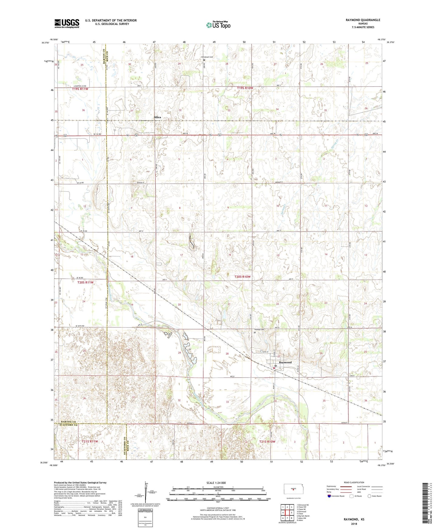
2022 topographic map quadrangle Raymond in the state of Kansas. Scale: 1:24000. Based on the newly updated USGS 7.5' US Topo map series, this map is in the following counties: Rice, Barton, Stafford. The map contains contour data, water features, and other items you are used to seeing on USGS maps, but also has updated roads and other features. This is the next generation of topographic maps. Printed on high-quality waterproof paper with UV fade-resistant inks.
Quads adjacent to this one:
West: Ellinwood
Northwest: Ellinwood NE
North: Chase NW
Northeast: Chase NE
East: Chase
Southeast: Alden
South: Alden NW
Southwest: Big Salt Marsh
This map covers the same area as the classic USGS quad with code o38098c4.
Contains the following named places: Agchoice - Emporia Grain Elevator Number 1, Chase Golf Course, City of Raymond, Delta Egg Farm, Hilltop Cemetery, Immanuel Cemetery, Peters Landing Field, Raymond, Raymond Baptist Church, Raymond Fire Department, Raymond Post Office, Raymond Wastewater Plant, Sieker Farms, Silica, Silica Grain Elevator Number 1, Township of Raymond, ZIP Codes: 67524, 67573