MyTopo
Sterling Kansas US Topo Map
Couldn't load pickup availability
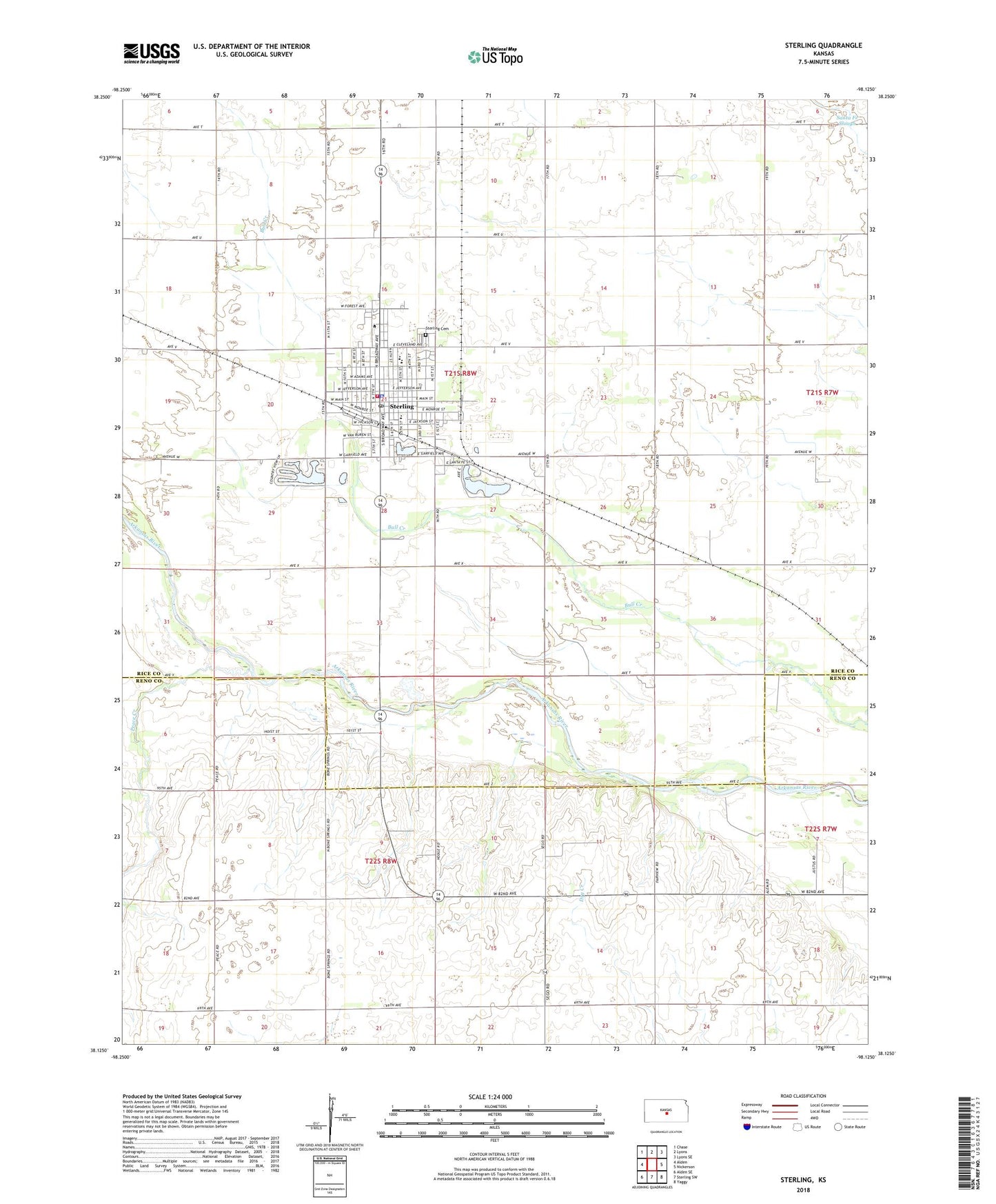
2022 topographic map quadrangle Sterling in the state of Kansas. Scale: 1:24000. Based on the newly updated USGS 7.5' US Topo map series, this map is in the following counties: Rice, Reno. The map contains contour data, water features, and other items you are used to seeing on USGS maps, but also has updated roads and other features. This is the next generation of topographic maps. Printed on high-quality waterproof paper with UV fade-resistant inks.
Quads adjacent to this one:
West: Alden
Northwest: Chase
North: Lyons
Northeast: Lyons SE
East: Nickerson
Southeast: Yaggy
South: Sterling SW
Southwest: Alden SE
This map covers the same area as the classic USGS quad with code o38098b2.
Contains the following named places: Assembly of God Church, Bull Creek Oil Field, Calvary Baptist Church, City of Sterling, Dymond Oil Field, First Baptist Church, First United Methodist Church, Peace Creek, Reformed Presbyterian Church, Santa Fe Slough, Sterling, Sterling Airport, Sterling Cemetery, Sterling Chamber of Commerce, Sterling City Hall, Sterling College, Sterling Free Public Library, Sterling Grade School, Sterling Grant Chapel, Sterling High School, Sterling Junior High School, Sterling Municipal Power Plant, Sterling Oil Field, Sterling Police Department, Sterling Post Office, Sterling Southwest Oil Field, Sterling Volunteer Fire Department, Sterling Wastewater Plant, Township of Medford, Township of Sterling, Union School, United Presbyterian Church of Sterling, ZIP Code: 67579