MyTopo
Beaumont Kansas US Topo Map
Couldn't load pickup availability
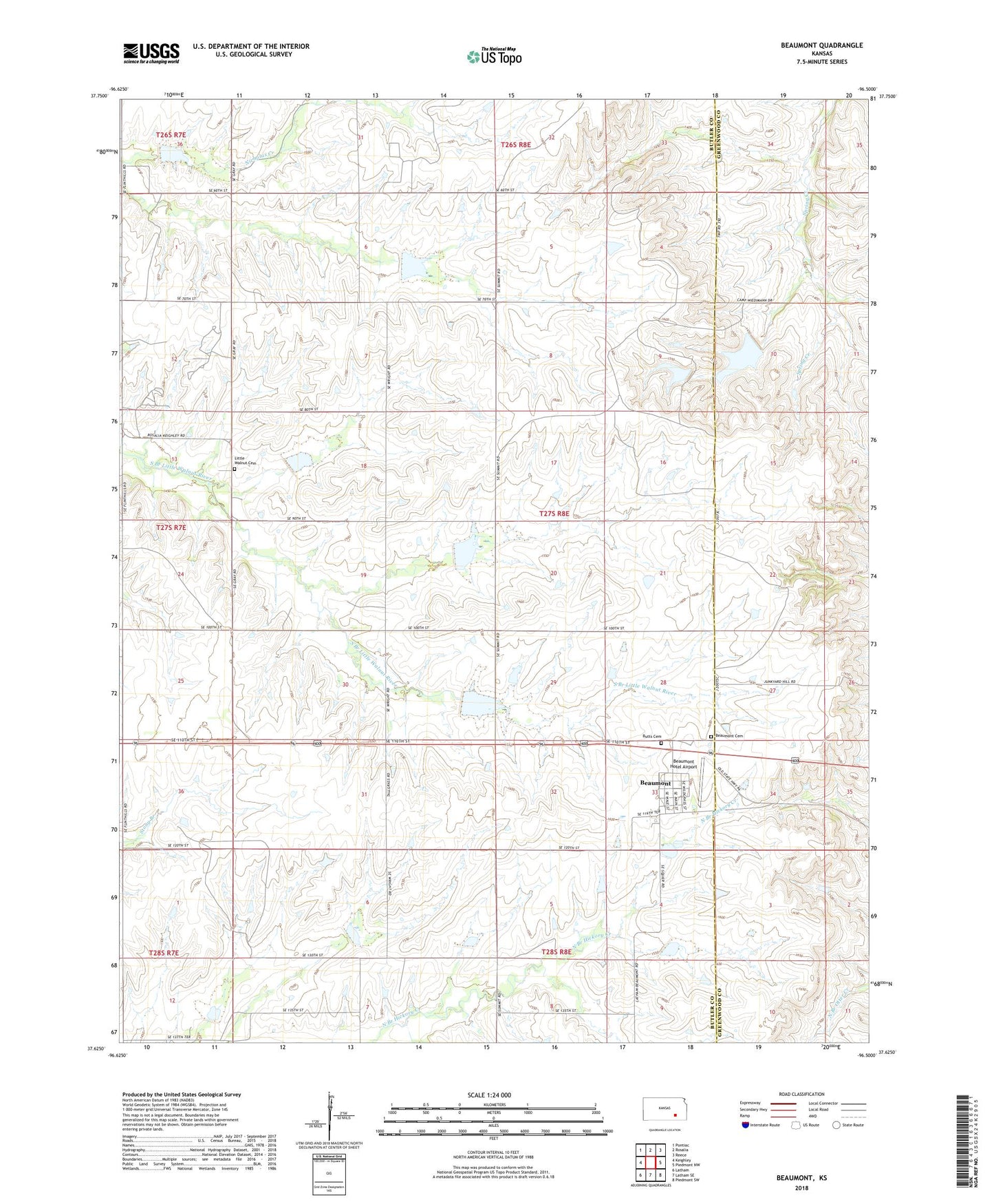
2022 topographic map quadrangle Beaumont in the state of Kansas. Scale: 1:24000. Based on the newly updated USGS 7.5' US Topo map series, this map is in the following counties: Butler, Greenwood. The map contains contour data, water features, and other items you are used to seeing on USGS maps, but also has updated roads and other features. This is the next generation of topographic maps. Printed on high-quality waterproof paper with UV fade-resistant inks.
Quads adjacent to this one:
West: Keighley
Northwest: Pontiac
North: Rosalia
Northeast: Reece
East: Piedmont NW
Southeast: Piedmont SW
South: Latham SE
Southwest: Latham
This map covers the same area as the classic USGS quad with code o37096f5.
Contains the following named places: Beaumont, Beaumont Cemetery, Beaumont Census Designated Place, Beaumont Hotel Airport, Butts Cemetery, Camp Wiedemann, Kansas Department of Transportation Greenwood County Rest Area, Little Walnut Church, Little Walnut Glencoe Cemetery, Lower Wiedemann Dam, Township of Glencoe, Upper Wiedemann Dam, ZIP Code: 67012