MyTopo
Keighley Kansas US Topo Map
Couldn't load pickup availability
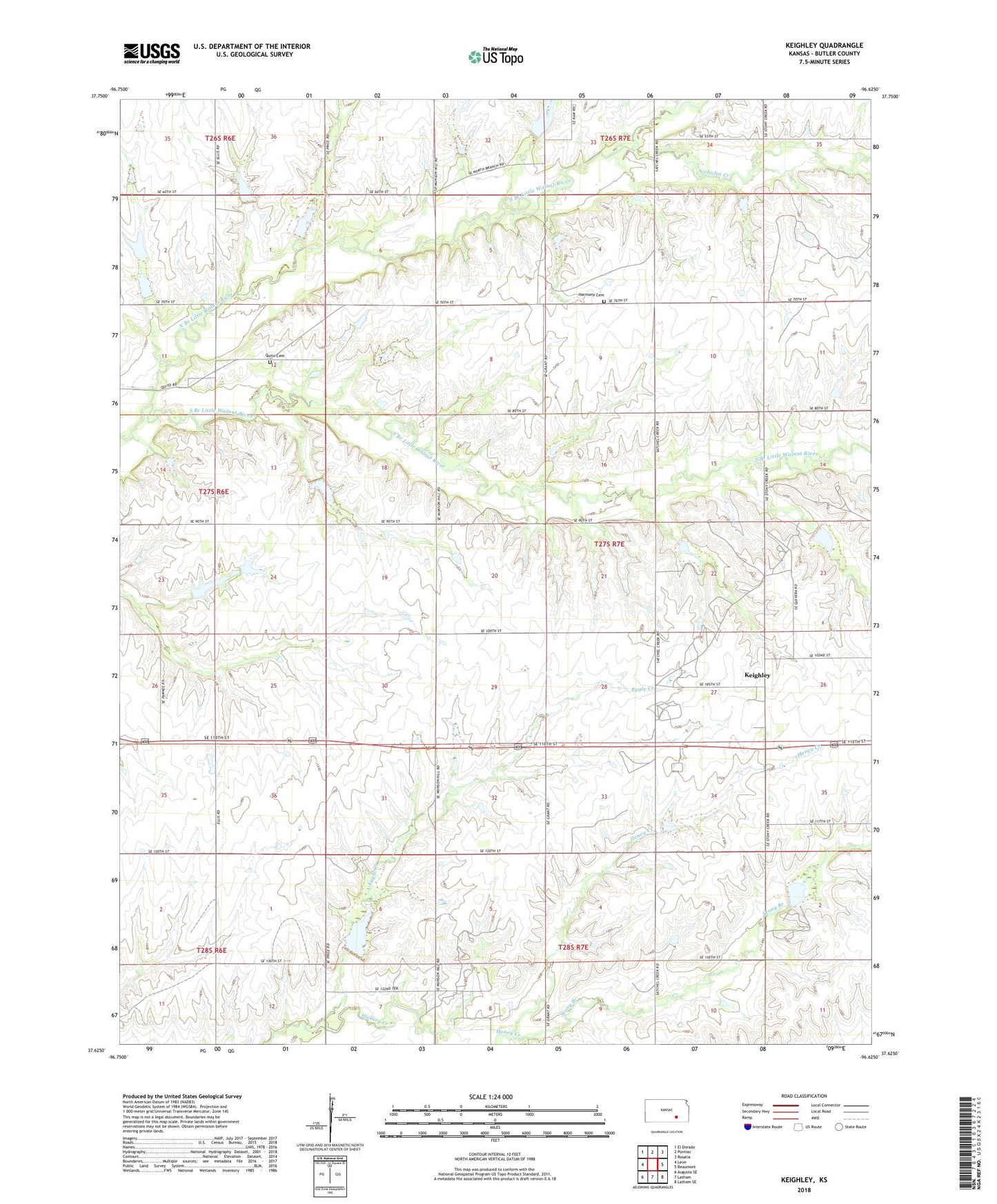
2022 topographic map quadrangle Keighley in the state of Kansas. Scale: 1:24000. Based on the newly updated USGS 7.5' US Topo map series, this map is in the following counties: Butler. The map contains contour data, water features, and other items you are used to seeing on USGS maps, but also has updated roads and other features. This is the next generation of topographic maps. Printed on high-quality waterproof paper with UV fade-resistant inks.
Quads adjacent to this one:
West: Leon
Northwest: El Dorado
North: Pontiac
Northeast: Rosalia
East: Beaumont
Southeast: Latham SE
South: Latham
Southwest: Augusta SE
This map covers the same area as the classic USGS quad with code o37096f6.
Contains the following named places: Brandt-Sensenbaugh Oil Field, Eagle Creek, Harmony Cemetery, Keighley, Keighley Oil Field, Nicholas Creek, North Branch Little Walnut River, Quito Cemetery, South Branch Little Walnut River, Stony Branch, ZIP Code: 67074