MyTopo
Blue Rapids SW Kansas US Topo Map
Couldn't load pickup availability
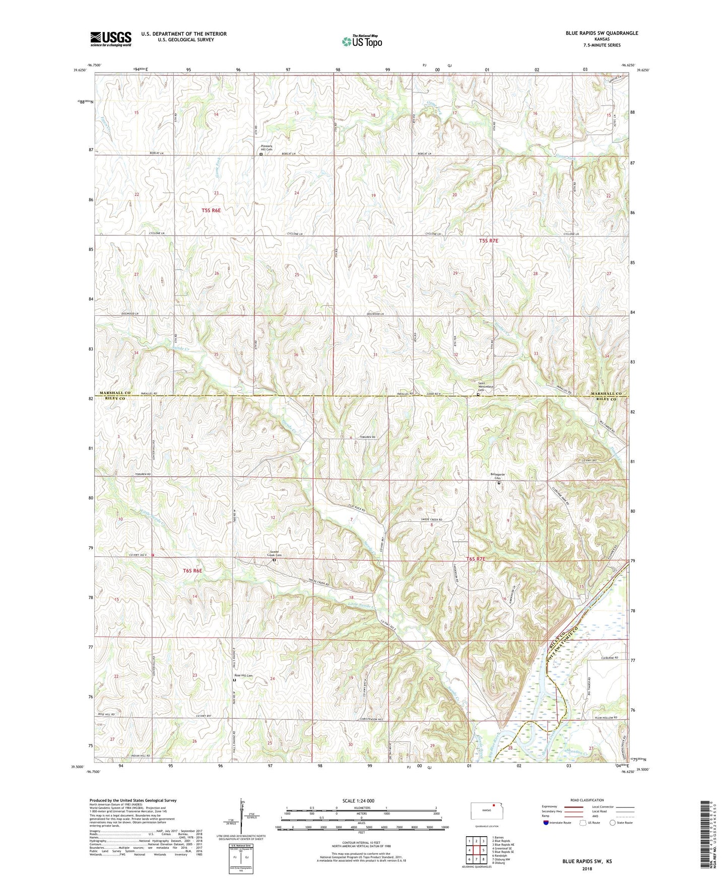
2022 topographic map quadrangle Blue Rapids SW in the state of Kansas. Scale: 1:24000. Based on the newly updated USGS 7.5' US Topo map series, this map is in the following counties: Marshall, Riley, Pottawatomie. The map contains contour data, water features, and other items you are used to seeing on USGS maps, but also has updated roads and other features. This is the next generation of topographic maps. Printed on high-quality waterproof paper with UV fade-resistant inks.
Quads adjacent to this one:
West: Greenleaf SE
Northwest: Barnes
North: Blue Rapids
Northeast: Blue Rapids NE
East: Blue Rapids SE
Southeast: Olsburg
South: Olsburg NW
Southwest: Randolph
This map covers the same area as the classic USGS quad with code o39096e6.
Contains the following named places: Bellegarde Cemetery, Center Hill School, Cleburne, Cottage Hill, Czeeh Church, Little Swede Creek, Pleasant Hill Cemetery, Prairie Ridge Community Hall, Riley County Fire District 1 Station 8, Roepke Landing Strip, Rose Hill Cemetery, Saint Wenceslaus Cemetery, Shannon Creek, Swede Creek, Swede Creek Cemetery, Swede Creek Recreation Area, Swede Creek United Methodist Church, Township of Blue Rapids, Township of Swede Creek