MyTopo
Barnes Kansas US Topo Map
Couldn't load pickup availability
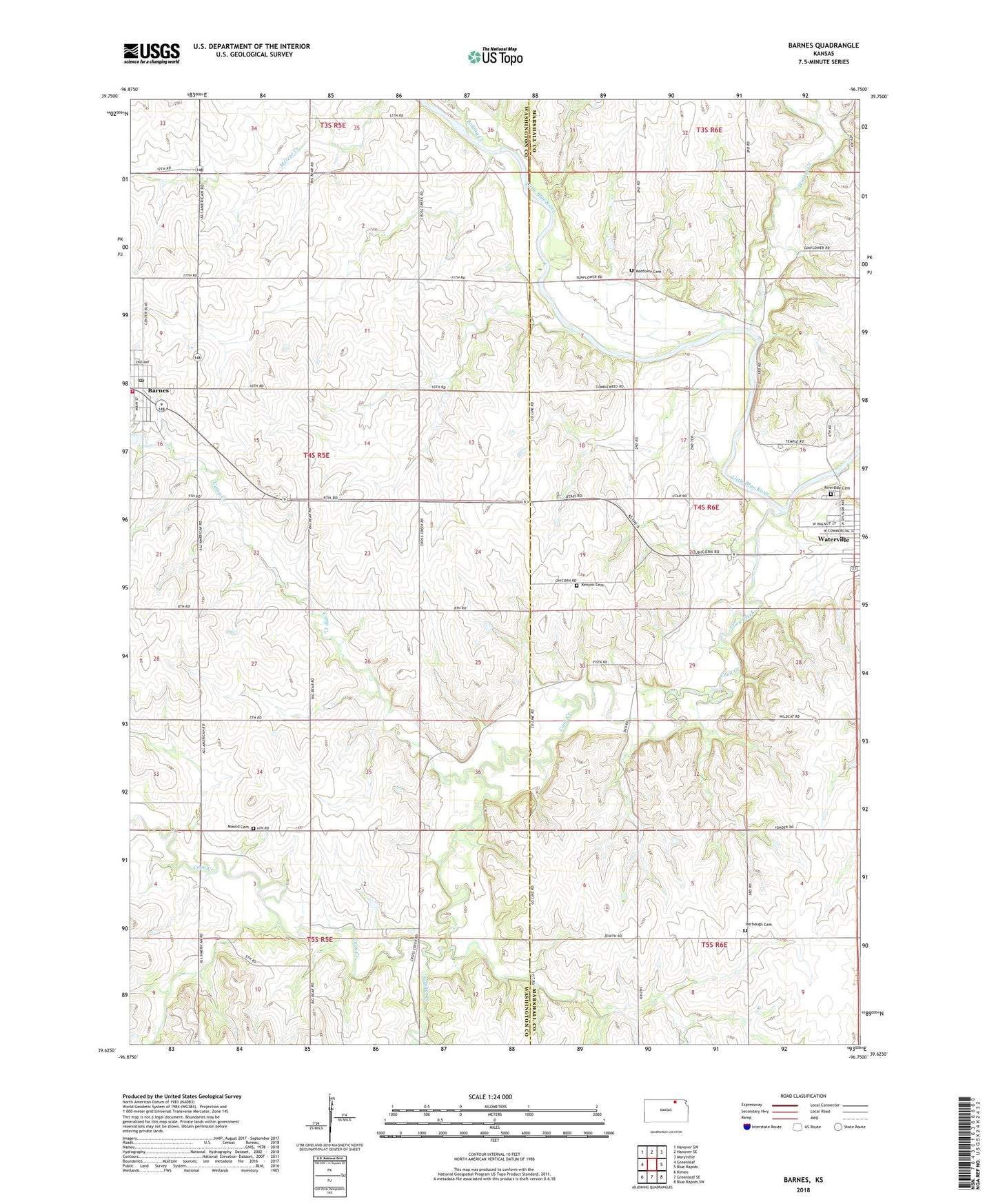
2022 topographic map quadrangle Barnes in the state of Kansas. Scale: 1:24000. Based on the newly updated USGS 7.5' US Topo map series, this map is in the following counties: Washington, Marshall. The map contains contour data, water features, and other items you are used to seeing on USGS maps, but also has updated roads and other features. This is the next generation of topographic maps. Printed on high-quality waterproof paper with UV fade-resistant inks.
Quads adjacent to this one:
West: Greenleaf
Northwest: Hanover SW
North: Hanover SE
Northeast: Marysville
East: Blue Rapids
Southeast: Blue Rapids SW
South: Greenleaf SE
Southwest: Kimeo
This map covers the same area as the classic USGS quad with code o39096f7.
Contains the following named places: Barnes, Barnes Methodist Church, Barnes Post Office, Barnes Rural Fire District 2, Barnes State Bank Museum, Barnes Wastewater Plant, Bolling Creek, Camp Creek, City of Barnes, Coon Creek, East Fork Walnut Creek, Harbaugh Cemetery, Kenyon Cemetery, Mound Cemetery, Mount Pleasant Cemetery, Riverside Cemetery, Sulphur Creek, Township of Barnes, Township of Waterville, Walnut Creek, ZIP Codes: 66548, 66933