MyTopo
Buckeye Kansas US Topo Map
Couldn't load pickup availability
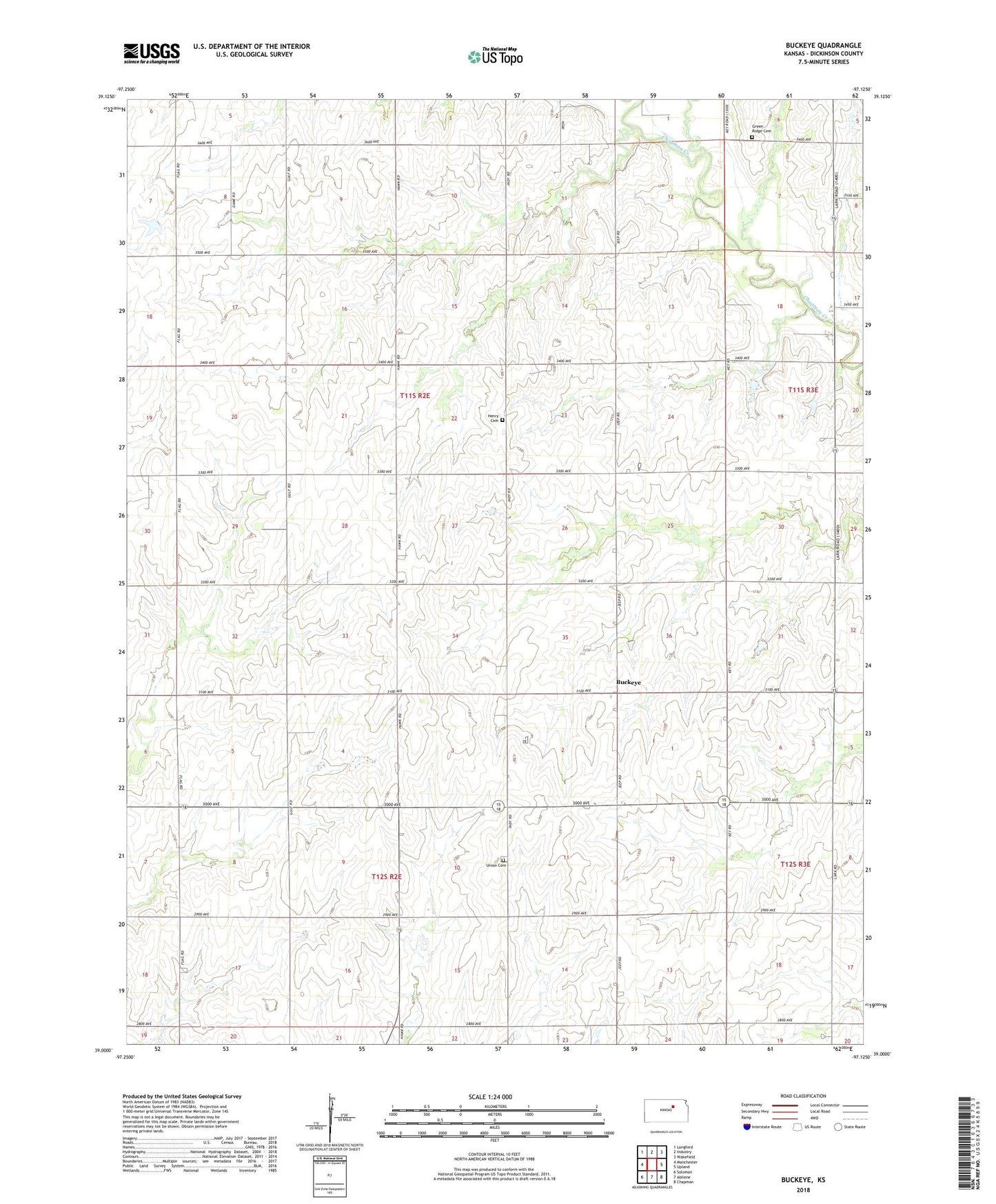
2022 topographic map quadrangle Buckeye in the state of Kansas. Scale: 1:24000. Based on the newly updated USGS 7.5' US Topo map series, this map is in the following counties: Dickinson. The map contains contour data, water features, and other items you are used to seeing on USGS maps, but also has updated roads and other features. This is the next generation of topographic maps. Printed on high-quality waterproof paper with UV fade-resistant inks.
Quads adjacent to this one:
West: Manchester
Northwest: Longford
North: Industry
Northeast: Wakefield
East: Upland
Southeast: Chapman
South: Abilene
Southwest: Solomon
This map covers the same area as the classic USGS quad with code o39097a2.
Contains the following named places: Bethany United Methodist Church, Buckeye, Cheever, Cheever Cemetery, Dry Branch, Green Ridge Cemetery, Township of Buckeye, Township of Cheever, Union Cemetery, Zion Brethren in Christ Church