MyTopo
Solomon Kansas US Topo Map
Couldn't load pickup availability
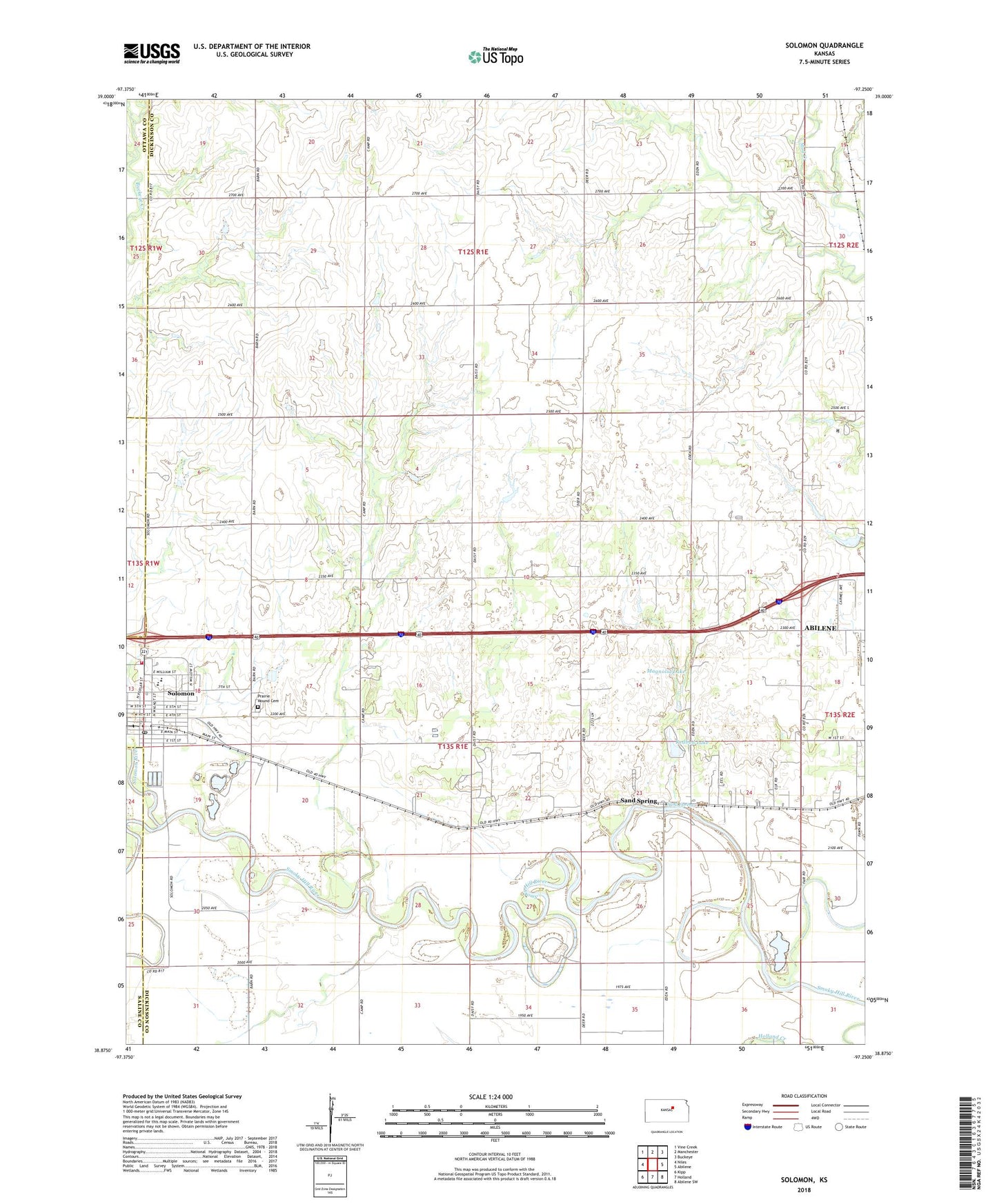
2022 topographic map quadrangle Solomon in the state of Kansas. Scale: 1:24000. Based on the newly updated USGS 7.5' US Topo map series, this map is in the following counties: Dickinson, Saline, Ottawa. The map contains contour data, water features, and other items you are used to seeing on USGS maps, but also has updated roads and other features. This is the next generation of topographic maps. Printed on high-quality waterproof paper with UV fade-resistant inks.
Quads adjacent to this one:
West: Niles
Northwest: Vine Creek
North: Manchester
Northeast: Buckeye
East: Abilene
Southeast: Abilene SW
South: Holland
Southwest: Kipp
This map covers the same area as the classic USGS quad with code o38097h3.
Contains the following named places: Abilene Water Plant, Buchanan, City of Solomon, First Presbyterian Church, Greatlife Golf and Fitness Chisholm Trail Golf Course, Johnson Community Center, King Solomon Camp, Magnolia Lake, Prairie Mound Cemetery, Redbud Lake, Sand Spring, Solomon, Solomon City Hall, Solomon Elementary School, Solomon Fire Department, Solomon High School, Solomon Post Office, Solomon Public Library, Solomon River, Solomon United Methodist Church, Solomon Wastewater Treatment Facility, Township of Lincoln, Willowdale Church